‘Season of Mist and Mellow Fruitfulness’: Autumn 2026 Forecast
With summer now firmly behind us, what lies ahead for South Africa during Autumn 2026?
Vox Weather Meteorologist Michelle du Plessis first looks back at the sometimes-extreme weather in February, and unpacks what we can expect for the beginning of the forthcoming cooler months.
(Featured image: View of Emmarentia Dam, Johannesburg, during Autumn)
South Africa experienced an extraordinary February 2026, marked by record rainfall in parts of the country, severe thunderstorms, intense heat, and stark regional contrasts in rainfall patterns. While the western and southern parts of the country received widespread above-normal rainfall, the north-eastern regions experienced a warmer and drier end to the summer season.
As Autumn begins to settle across the country, attention is now turning to the seasonal outlook and the possible influence of a developing El Niño later in the year.

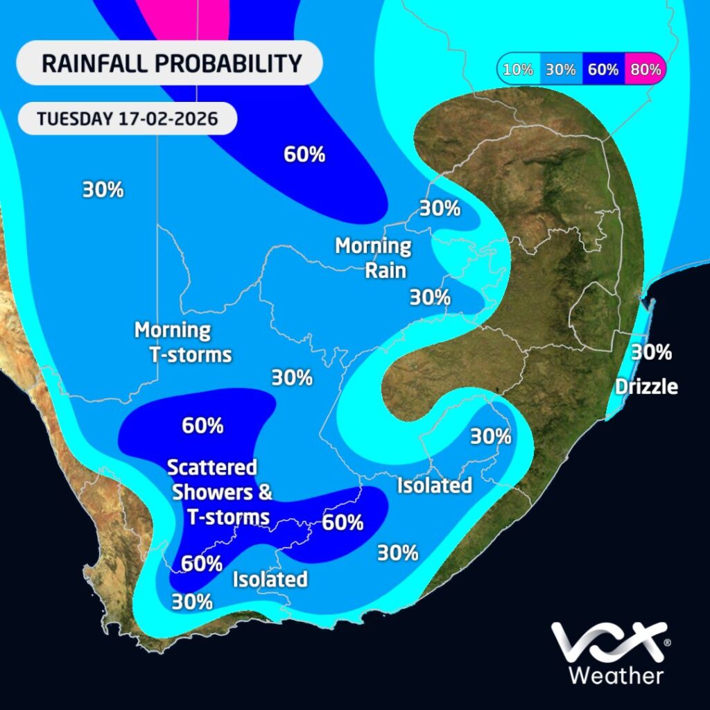
February 2026: Record Rainfall and Severe Weather
February brought much-needed rainfall to large parts of the drought-stricken Cape provinces. Rainfall anomaly maps clearly show the regional contrast across the country: the north-eastern interior experienced a hotter and drier end to summer, while the Western and Eastern Cape saw significantly wetter conditions.
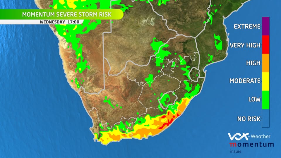
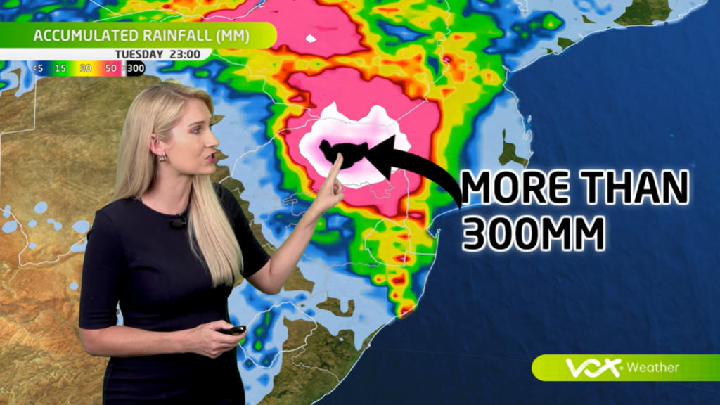
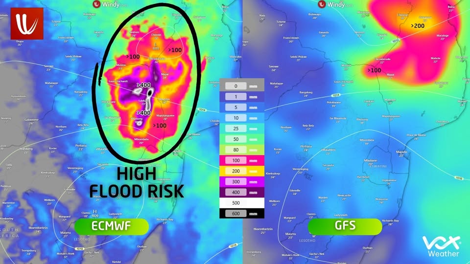
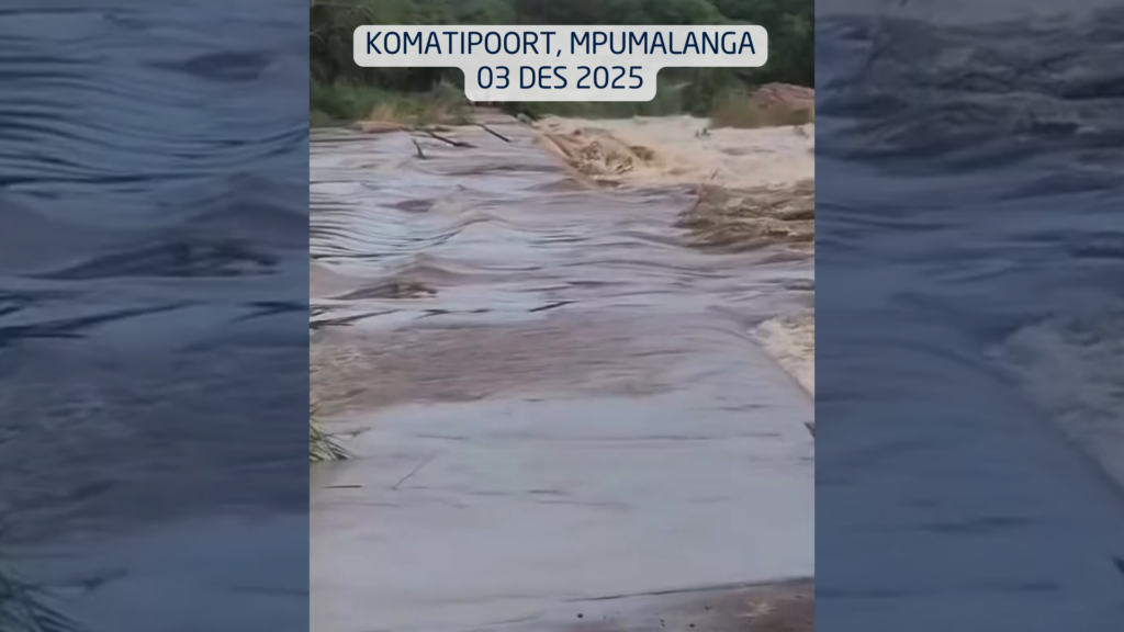
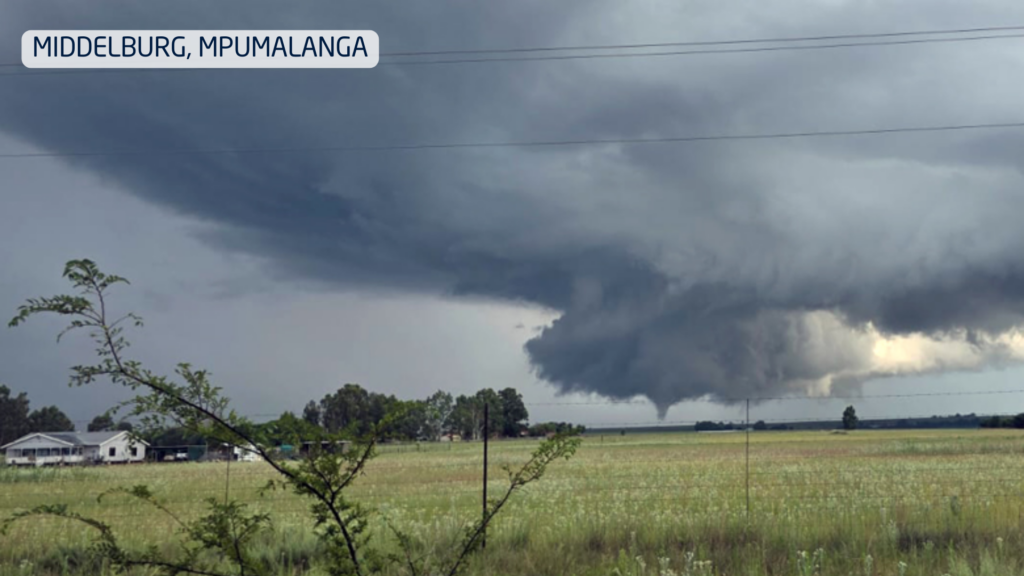
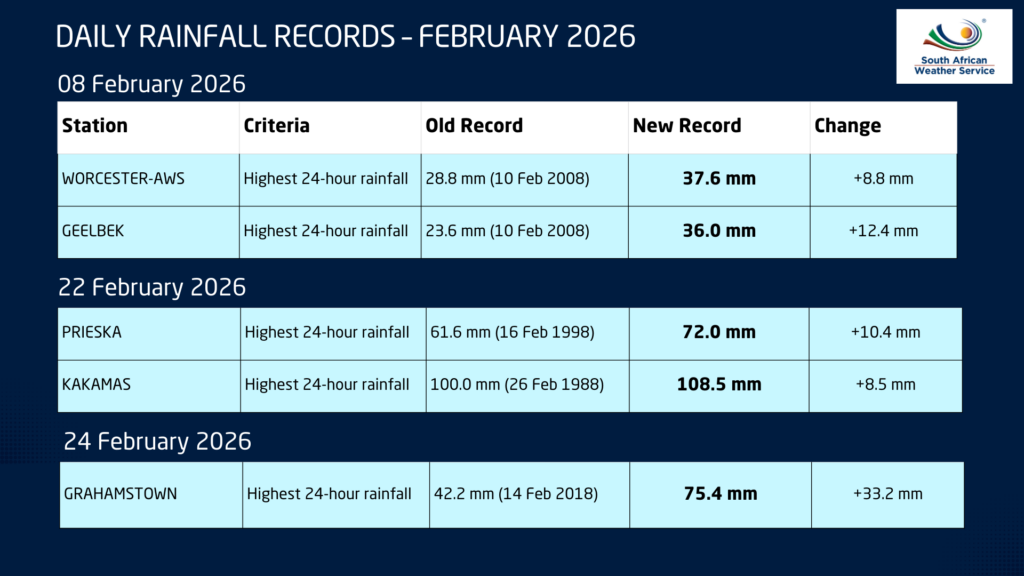
Not only did above-normal rainfall occur, but several rainfall records were also broken during the month. These events were largely driven by at least three strong cut-off low pressure systems that moved across the country, producing widespread rainfall and severe thunderstorms.
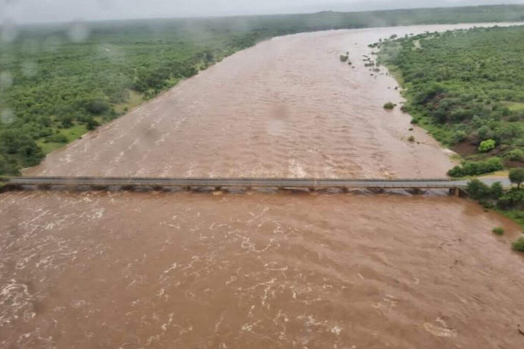
One notable event occurred in Kakamas, where more than 100 mm of rain fell on 22 February. Later in the month, Grahamstown also recorded exceptional rainfall when its February 24-hour rainfall record was broken. More than 75 mm fell within only a few hours on 24 February, exceeding the previous record by more than 33 mm.
Across social media, numerous photographs and videos captured the dramatic turnaround in water availability, with farmers and residents expressing gratitude for the long-awaited rainfall.
In Ladismith, the situation at the Tierkloof Dam highlighted the dramatic impact of the rainfall. On 2 February 2026, the dam was so depleted that the local municipality had to close the outlet valves to protect infrastructure. After heavy rainfall on 9 February, however, the dam began overflowing within just a week — an extraordinary turnaround.
Rivers also responded rapidly to the rainfall. By 11 February, the Vis River was flowing strongly again, while in George the well-known Pepsi Pools experienced strong runoff following the rains.
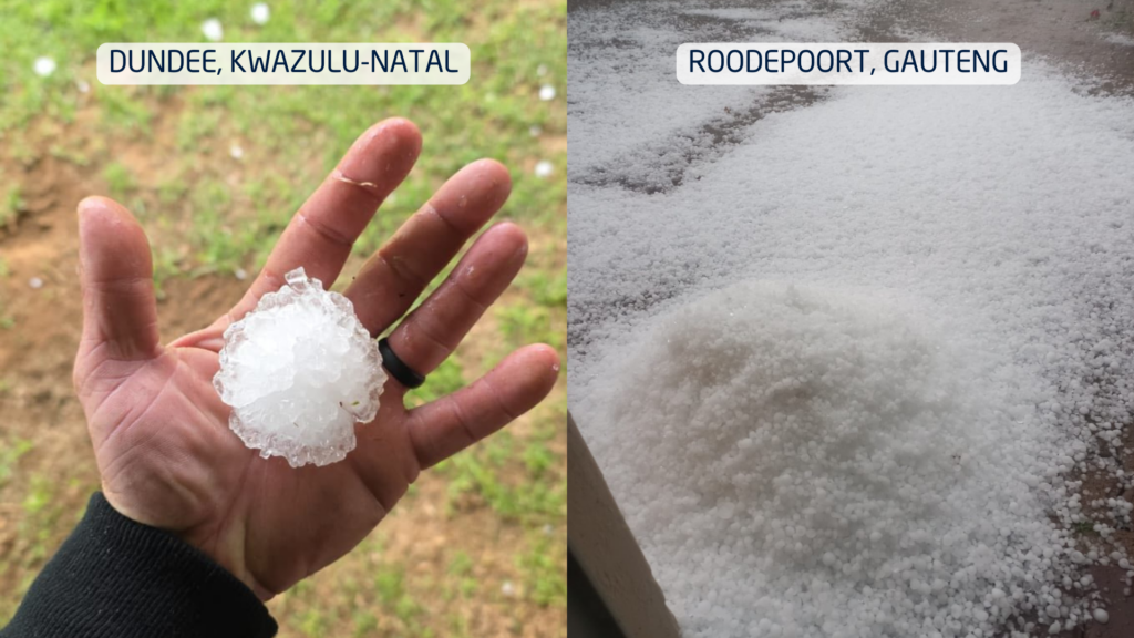
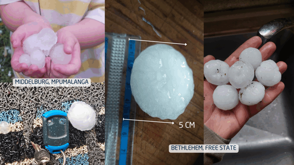
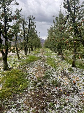
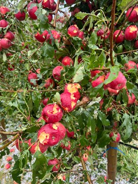
Unfortunately, the severe weather also brought destructive storms. Hailstorms in the Southern Cape caused significant damage to fruit farms in the Langkloof region, highlighting the dual nature of intense summer rainfall events.
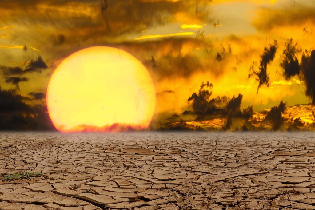
February was not only wet in parts of the country, but also exceptionally hot. Above-normal temperatures were recorded across the eastern and southern regions.
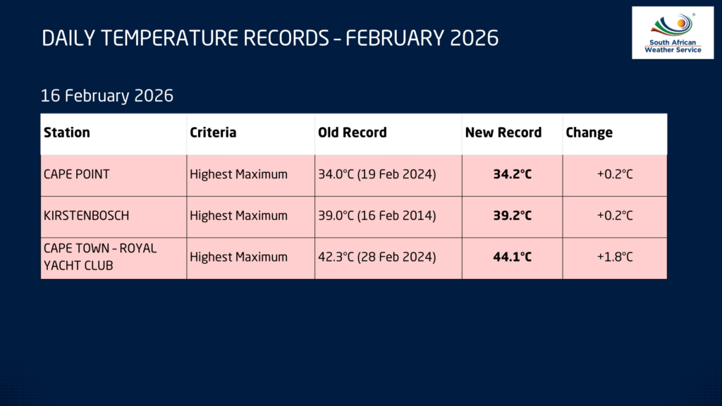
Cape Town once again broke its maximum temperature record when temperatures soared to 44°C on 16 February.
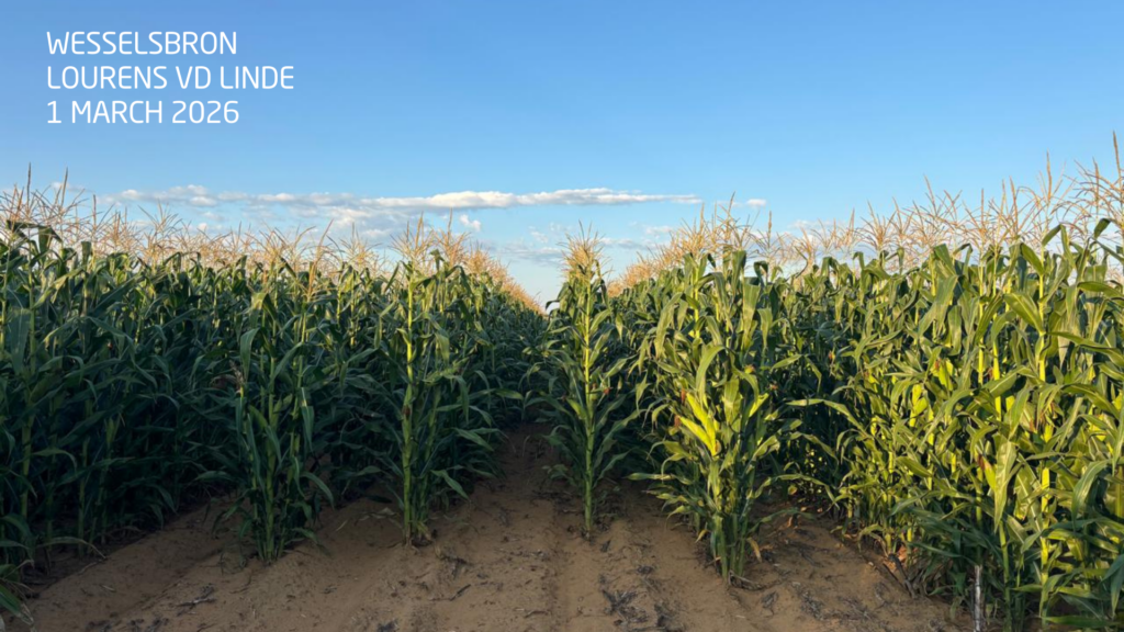
Elsewhere in the country, farmers in the Free State welcomed the rainfall ahead of the harvest season, with crops appearing particularly healthy this year. The Vaal Dam also remains exceptionally full, and there is even the possibility that it could remain at or near full capacity for an entire year — something that may not have occurred in the past two decades, and possibly even longer.
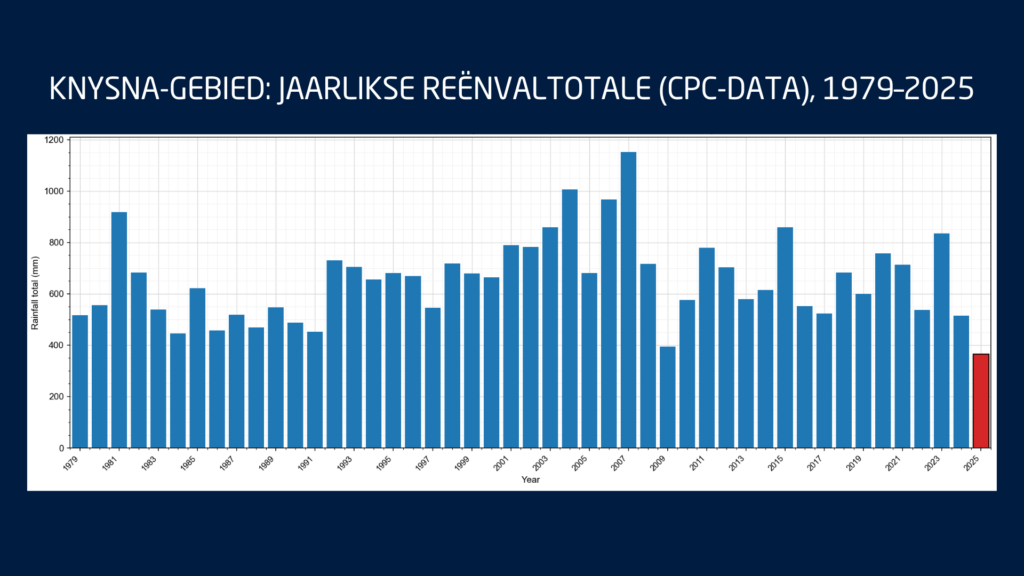
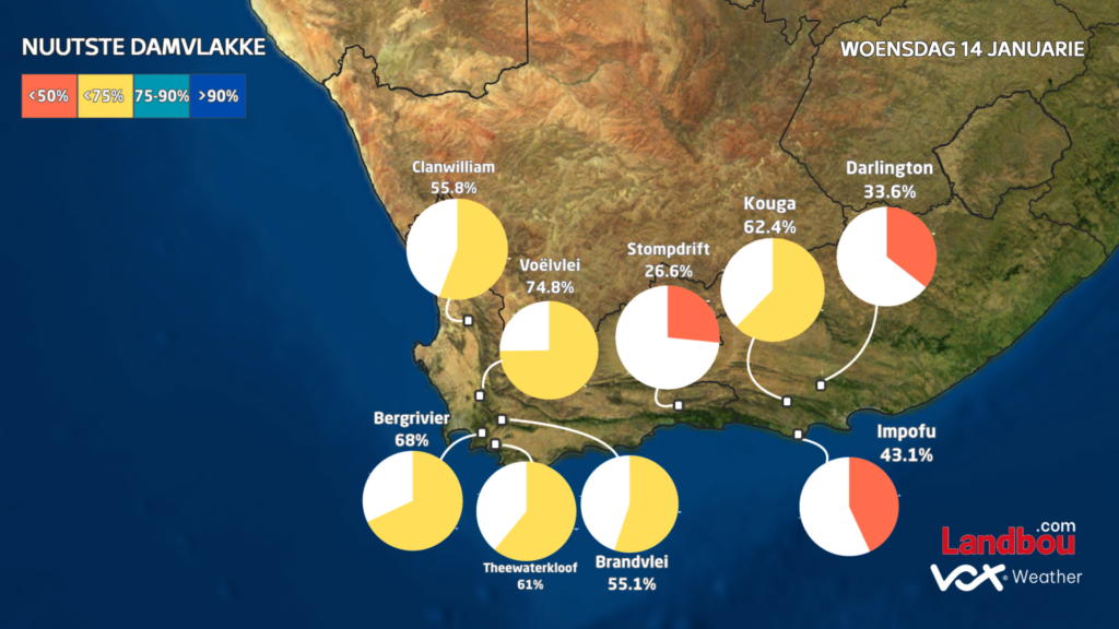
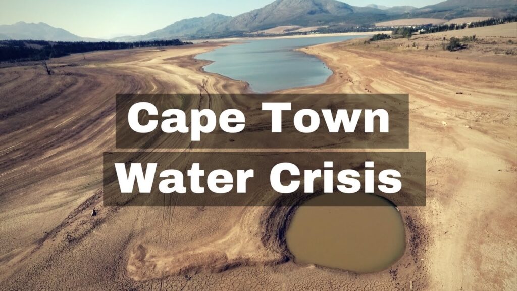
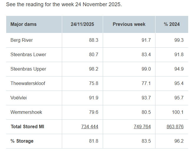
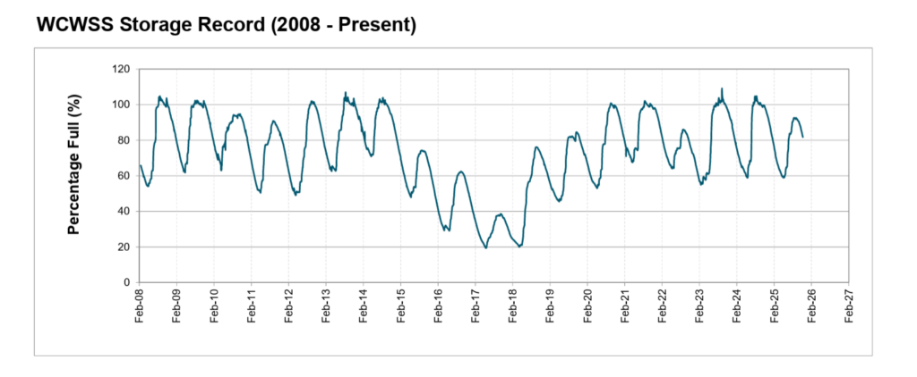
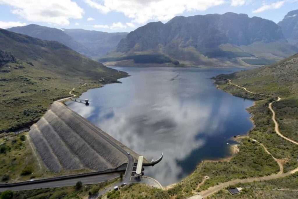
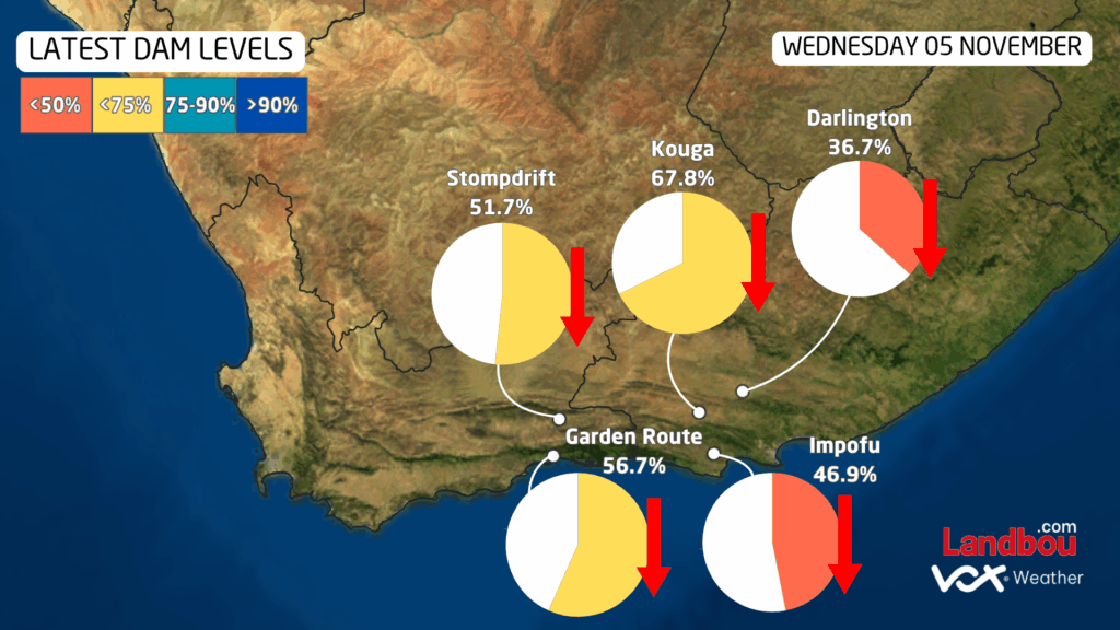
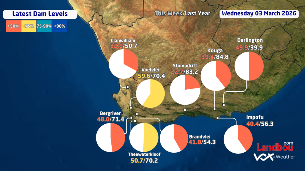
Despite these positive developments in parts of the country, dam levels in the Cape provinces remain a concern.
Dam levels in the Western and Southern Cape are currently significantly lower than they were at the same time last year. The Kouga Dam currently stands at only 39% capacity compared to 84% a year ago, while the Theewaterskloof Dam is approximately 50% full compared to 70% at the same time last year. Across the Western Cape as a whole, the average dam level currently sits at around 49.7%, compared to 65.8% a year ago.
Autumn Arrives with the First Cold Front
Autumn has also made an early appearance across parts of the country. The first strong cold front of the season swept across South Africa at the start of March, bringing much cooler conditions. On the morning of 2 March, light frost was recorded in parts of the interior, with temperatures in Sutherland dropping to near and even below freezing.
However, it is important to note that an early frost or early cold conditions do not necessarily mean that the coming winter will be colder or wetter. For this reason, forecasts currently focus primarily on the Autumn outlook rather than drawing conclusions about the winter season.
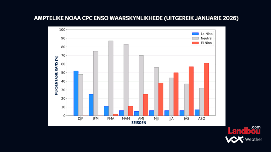
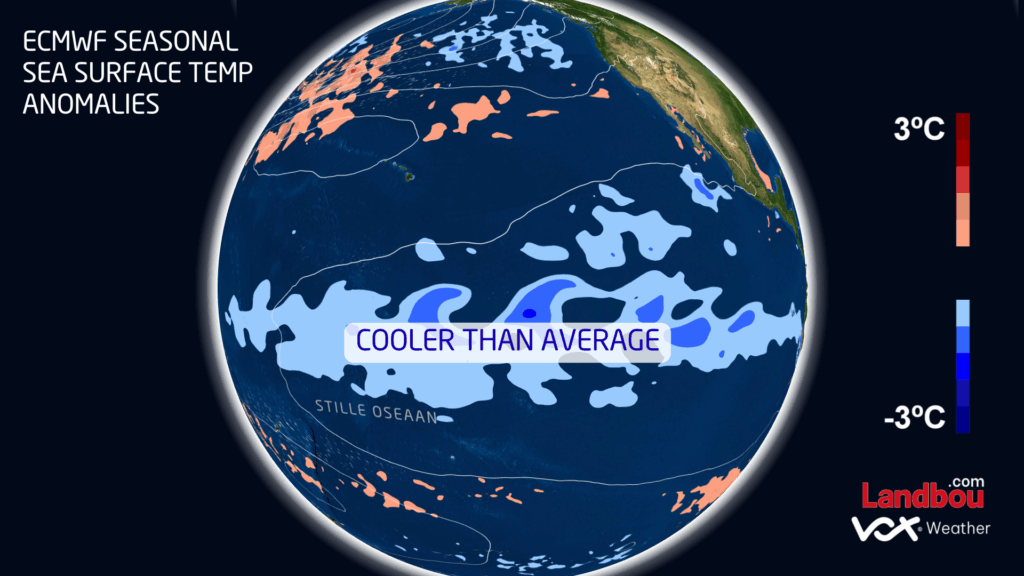
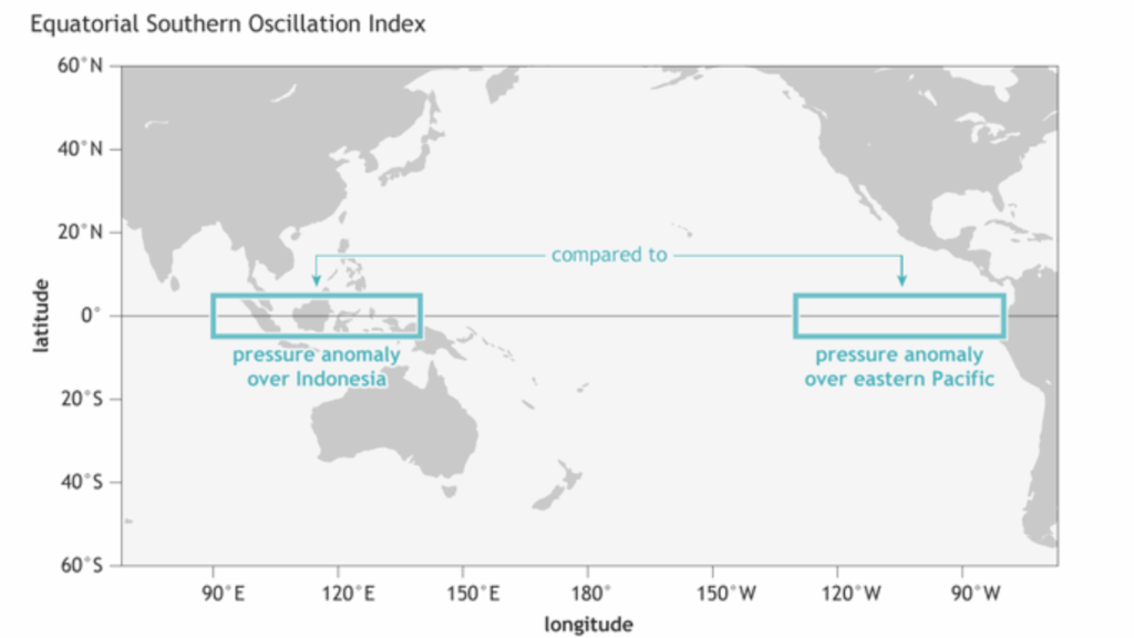
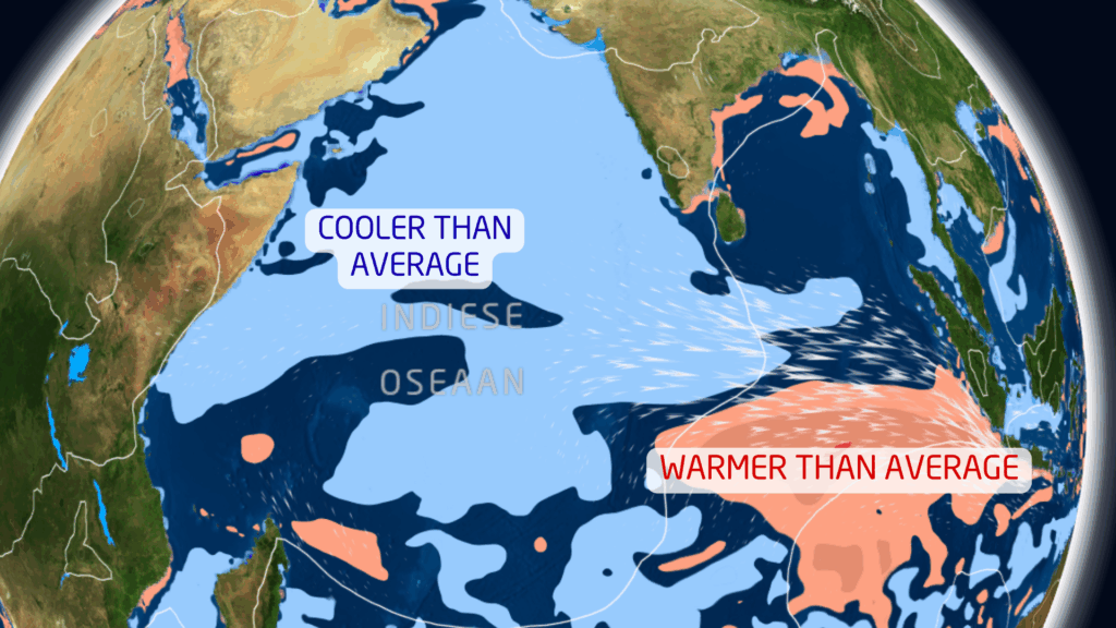
ENSO Outlook and the Possibility of El Niño
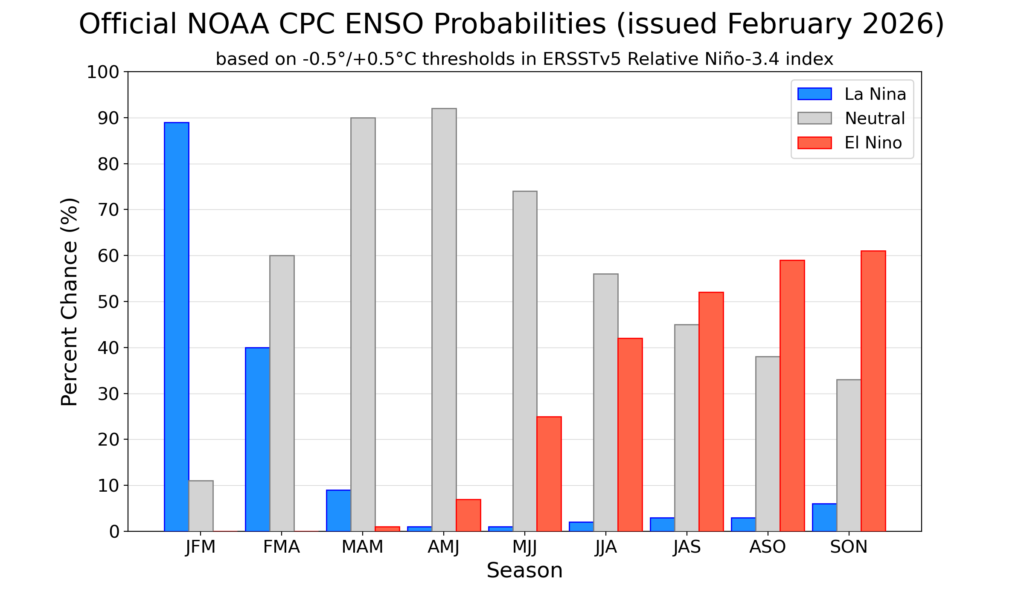
Current projections indicate that the ENSO system is likely to return to a neutral state during Autumn. Some models suggest that conditions could then shift relatively quickly toward an El Niño phase later in the year, potentially developing toward the end of winter and continuing into summer.
If this scenario materialises, it could have implications for rainfall patterns during the next summer rainfall season. However, it is still too early to determine the exact impacts of a potential El Niño event.
Interestingly, if El Niño development is delayed until later in the year, it could even allow for favourable spring rainfall conditions before the event fully establishes itself.
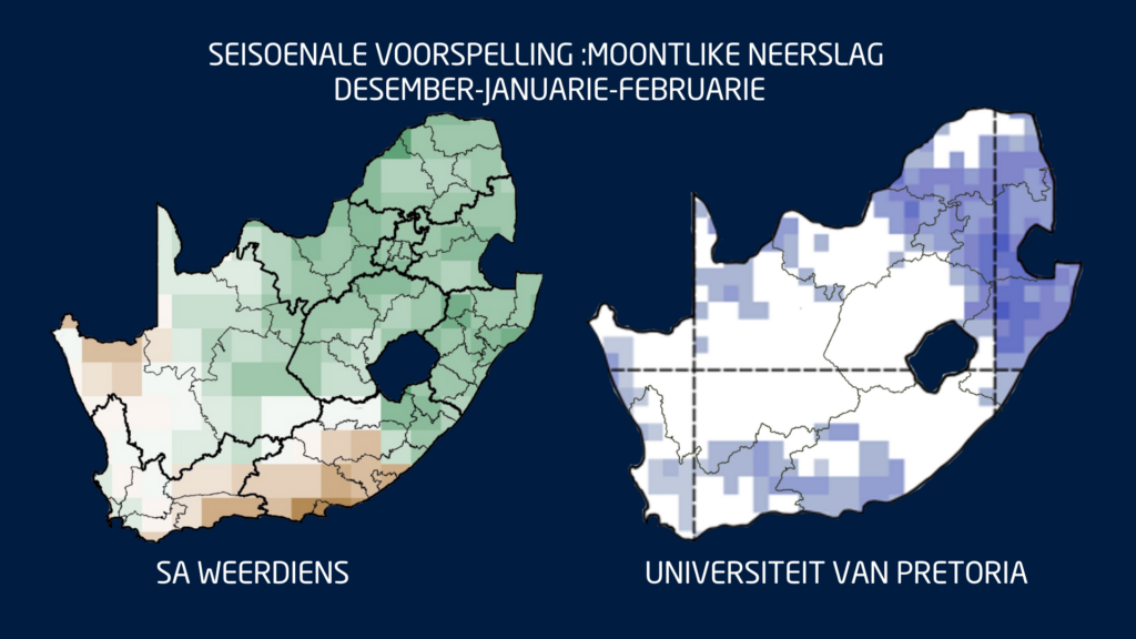
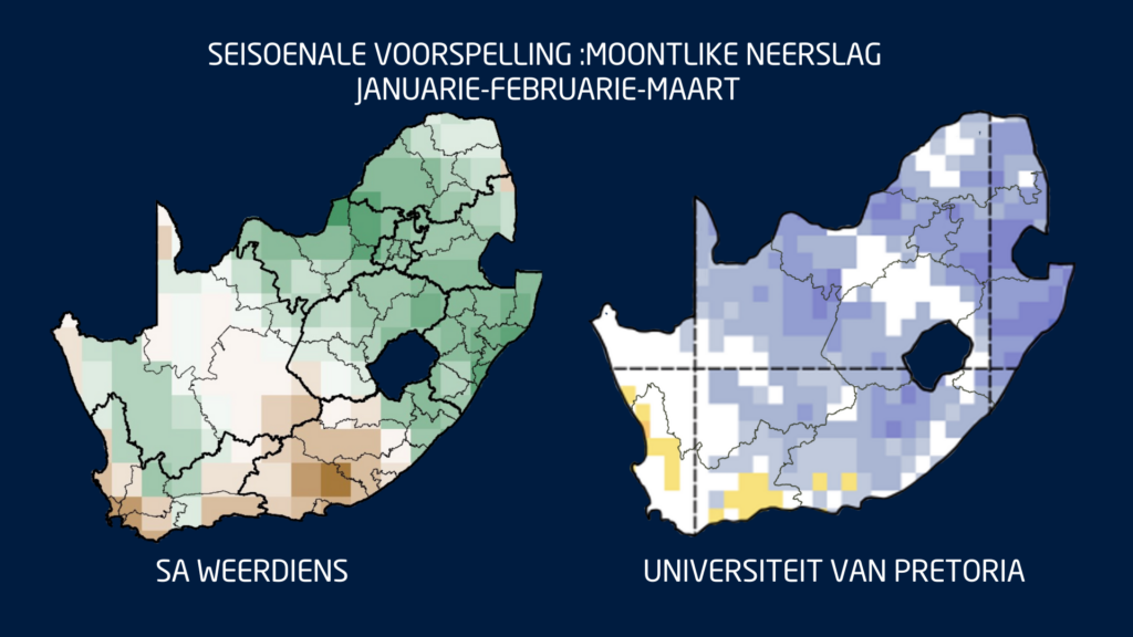
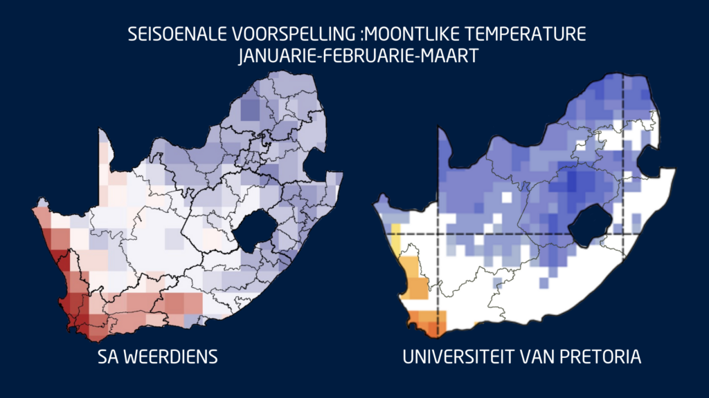
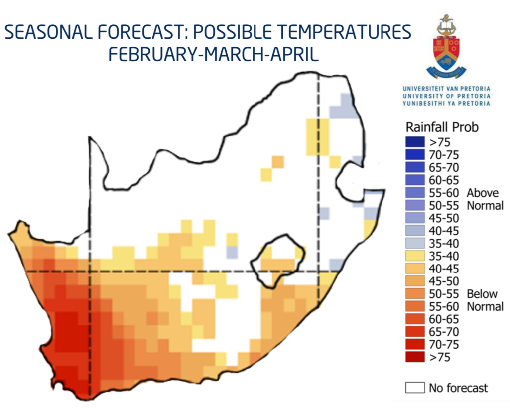
Seasonal Outlook and Model Uncertainty
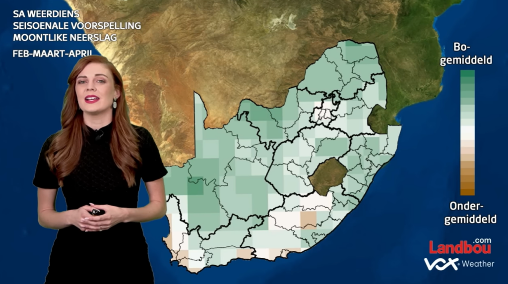
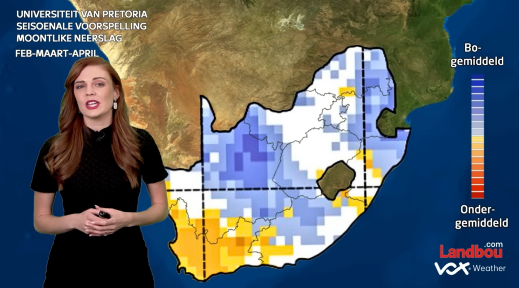
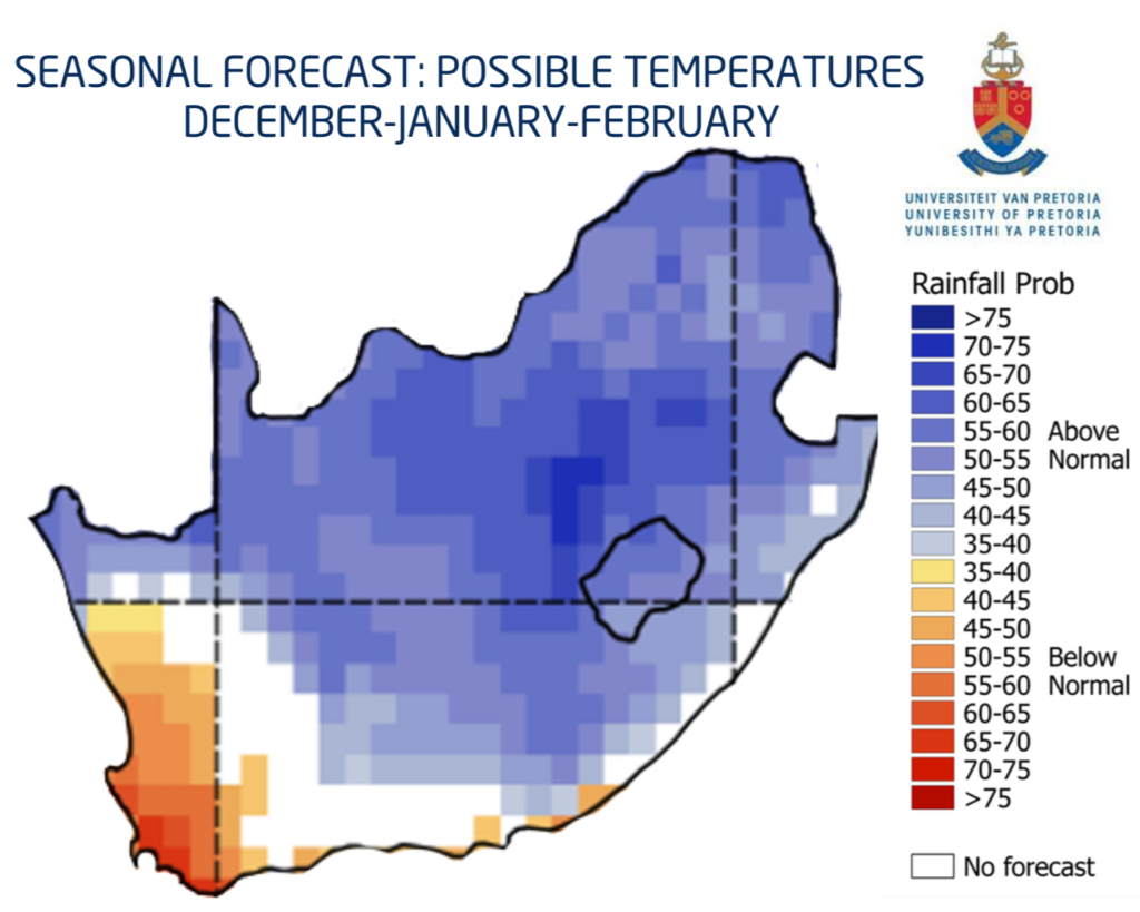
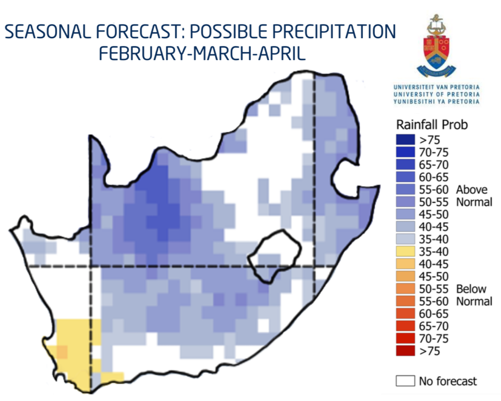
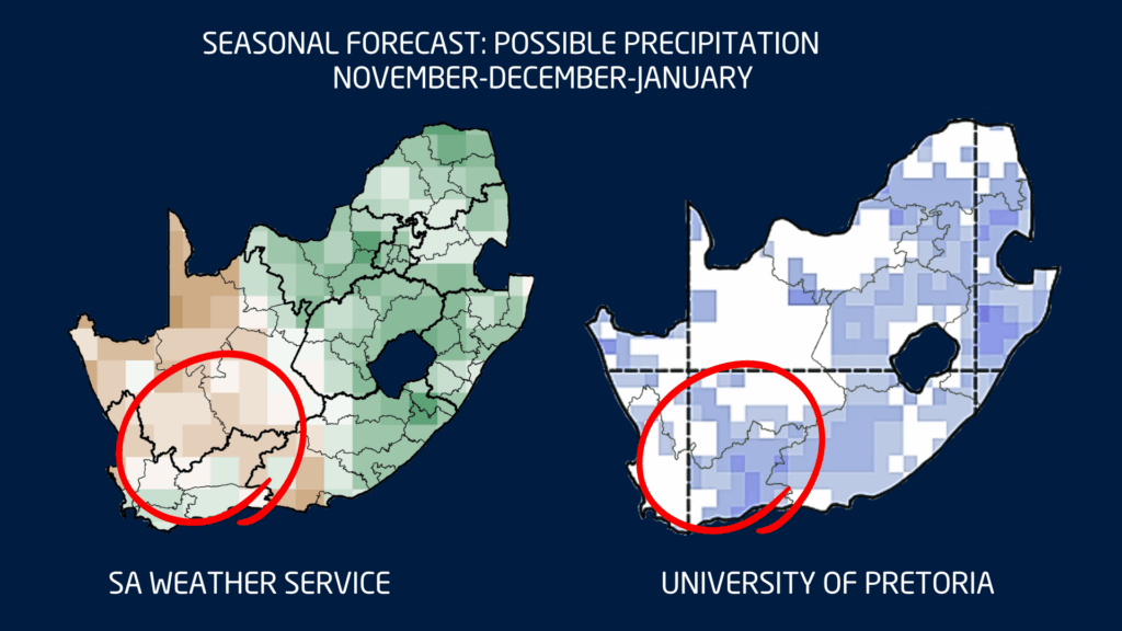
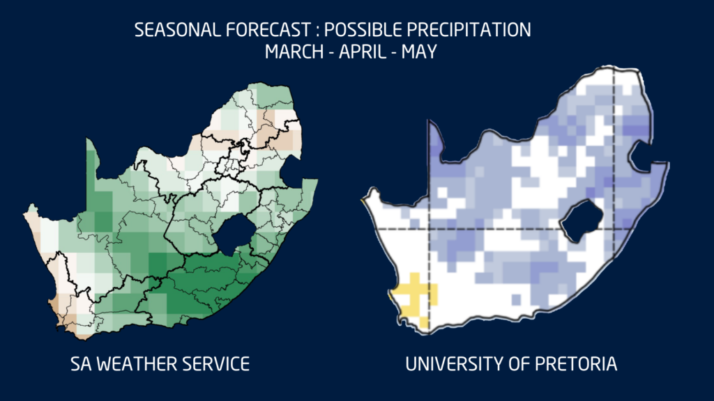
At present, both the South African Weather Service (SAWS) and the University of Pretoria’s seasonal forecasting models indicate the possibility of above-normal rainfall over parts of the interior during the next three months. The signal is particularly strong over sections of the Eastern Cape.
However, both modelling systems also suggest the potential for drier-than-normal conditions over the western parts of the Western Cape and along the West Coast.
It is important to keep in mind that the predictive skill of rainfall forecasts is currently weaker for the western regions of the country, which means the outlook for these areas remains more uncertain.
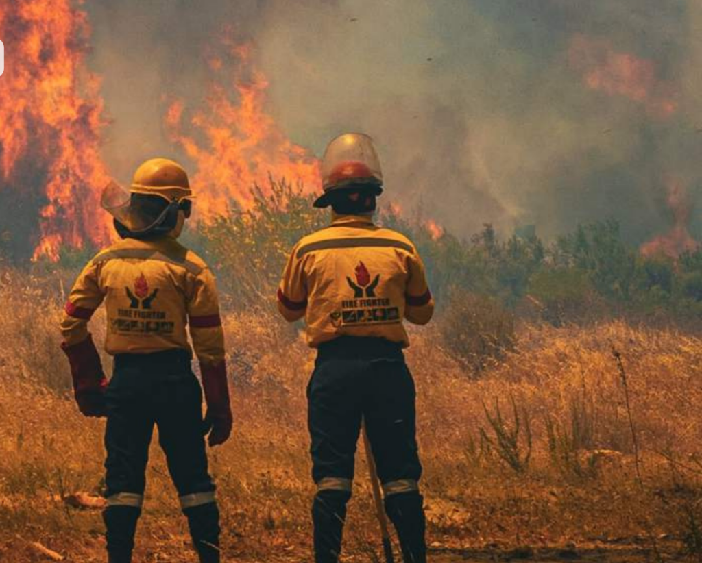
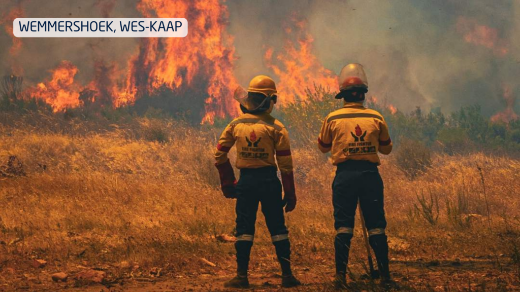
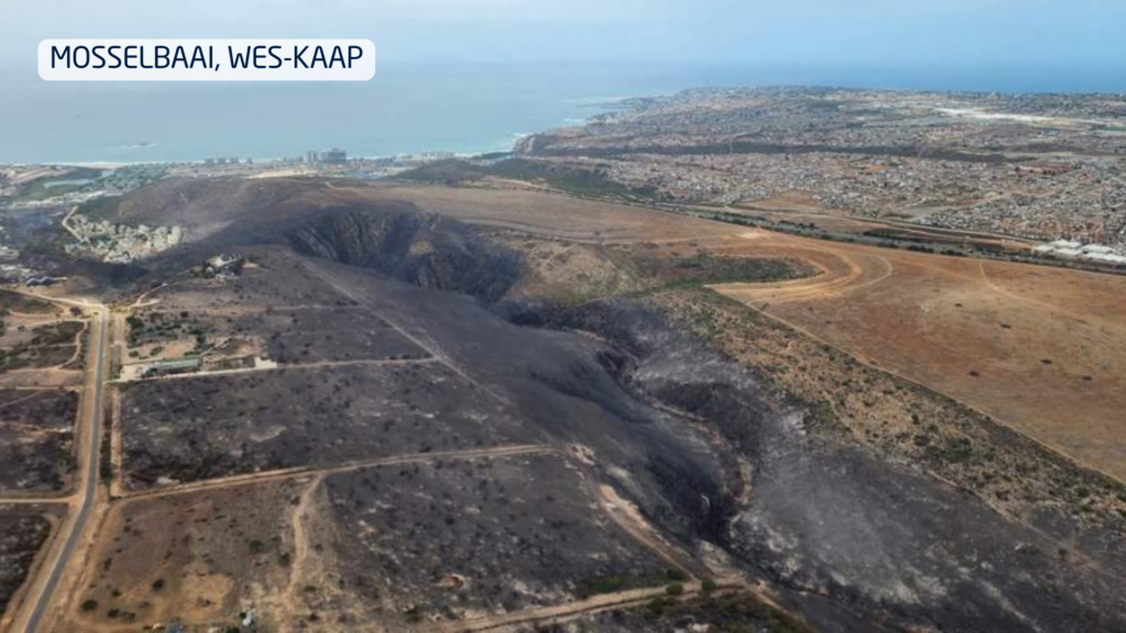
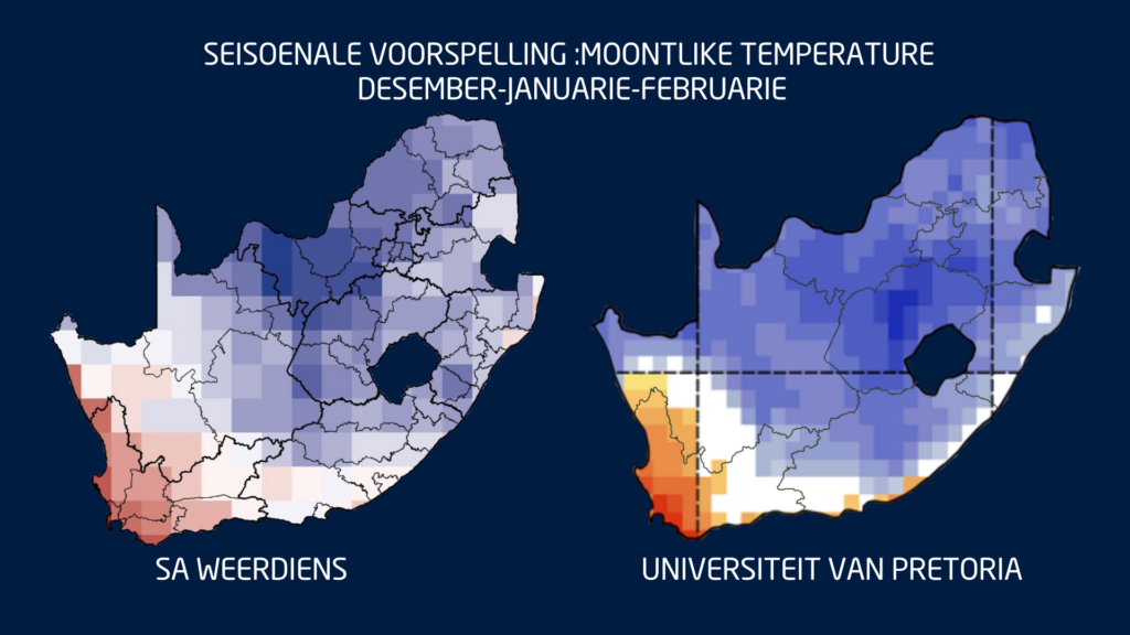
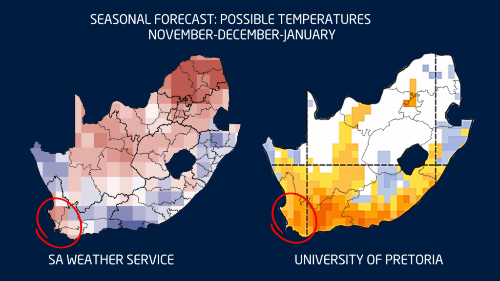
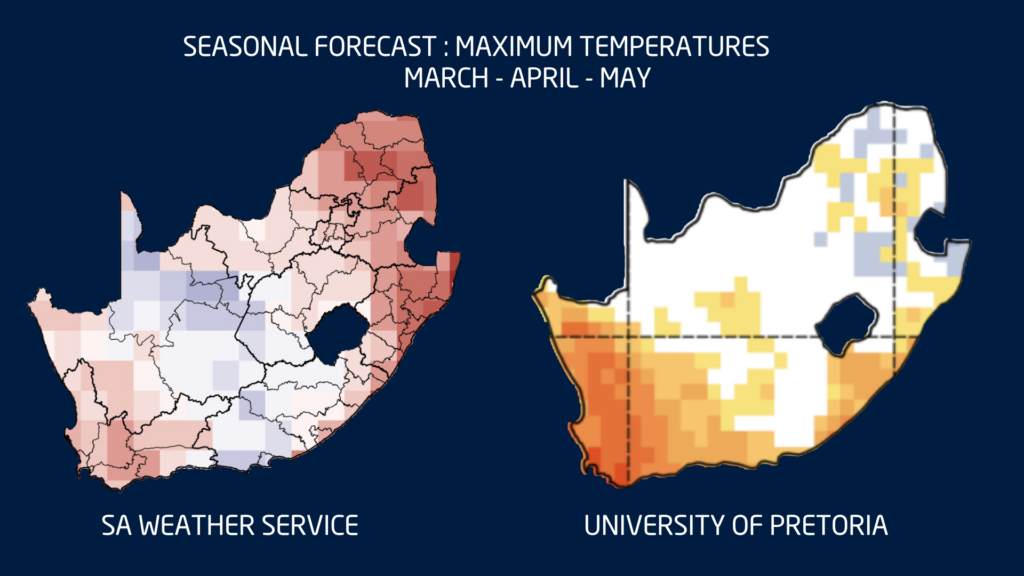
Seasonal temperature forecasts for March, April and May also indicate a strong likelihood of warmer-than-normal conditions across much of the country. When combined with berg wind conditions, this could increase the risk of veld fires in some areas.
Looking further ahead toward winter, the various climate models do not currently agree on a clear rainfall signal. As a result, no firm conclusions should be drawn yet regarding the coming winter rainfall season.
This uncertainty is worth highlighting because last year both the SAWS and University of Pretoria models predicted below-normal rainfall for the winter rainfall region. In reality, the outcome differed somewhat. The far western parts of the country experienced more rainfall than predicted, while the models were more accurate over the central Karoo and parts of the Southern Cape where below-normal rainfall did occur.
A Season of Change
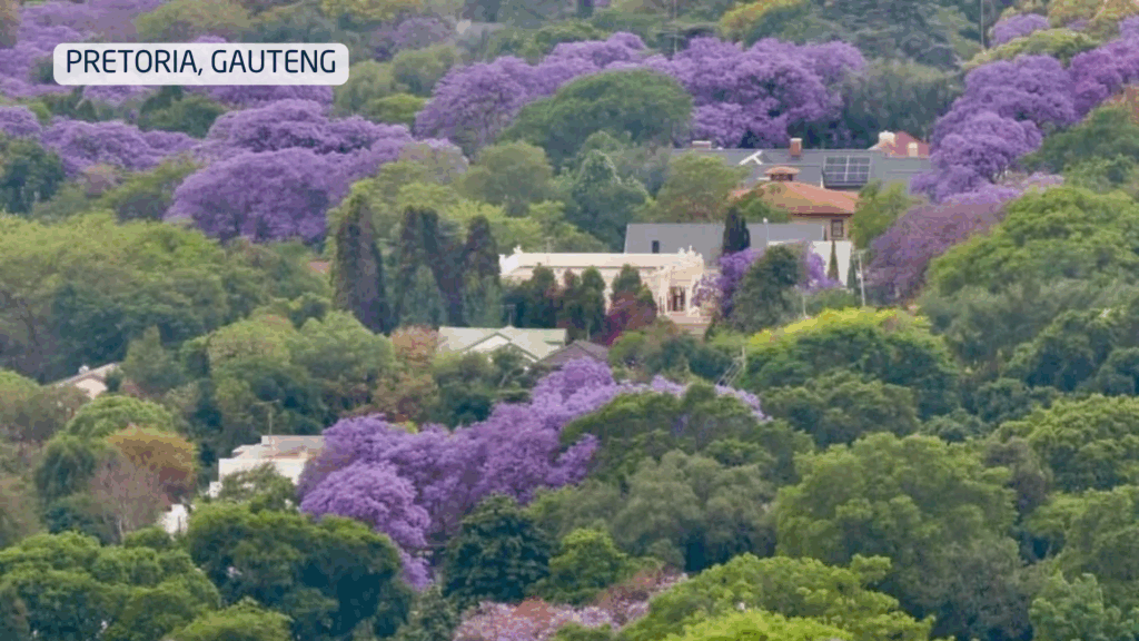
Across the country, the subtle signs of seasonal change are becoming more noticeable. Leaves are beginning to turn colour, the sun sets earlier in the evenings, and many people have already felt the first bite of cooler air in the mornings.
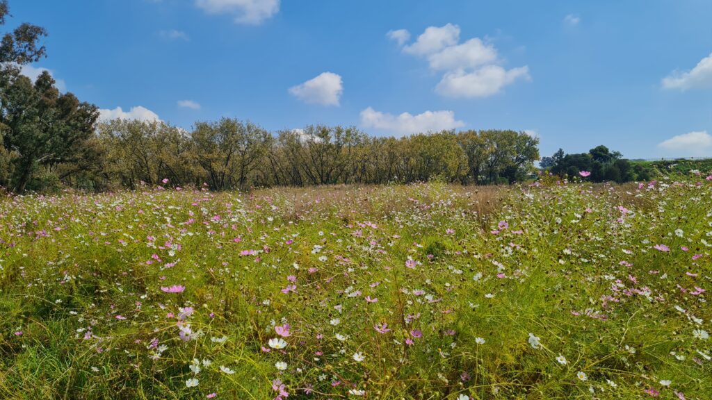
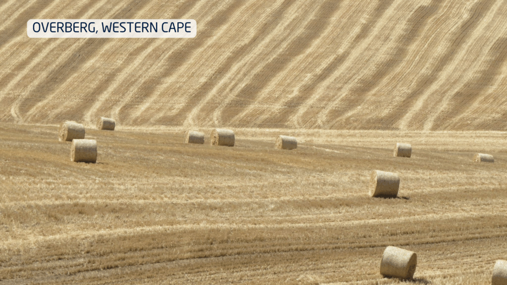
Autumn in South Africa brings mild days, cool nights and frequent morning mist. It’s the peak season for harvesting grapes as well as other fruit, with vineyards and orchards changing colour and offering scenic views. Elsewhere we find kilometres and kilometres of cosmos flowers in bloom.
And so Autumn remains one of the most pleasant seasons in South Africa, with moderate and comfortable weather across much of the country. Yet for many in the Cape provinces, the hope remains the same: that this Autumn will bring the rainfall needed to replenish reservoirs and provide relief ahead of the winter months.