Winter Impacts on Business
We saw a brutal start to South Africa’s winter season when a powerful winter storm initially swept across much of South Africa during the week of 09 to 13 June, bringing bitter cold, snow and heavy rain to several provinces, and with it the massive potential to disrupt businesses of all types. Now, we’ve seen even more snowfall during July.
The icy weather that we’ve seen is largely to do with the arrival of ‘cut-off low’ systems, meaning a weather system where very cold air becomes trapped and spins above the country. When the systems are unusually deep, stretching from the upper atmosphere all the way to the ground, this brings especially intense cold, rain and snow.
What impact does this have on business?
Besides the potential tragedy of loss of life for people in transit, extreme weather brings a variety of challenges.
Snow on the N3 generally interrupts supply chains, making it difficult to get goods in transit to businesses. The gale force winds experienced are, of course, disruptive to all travellers, as well as once again affecting supply chains. Gale force winds can also interfere with agricultural production, including causing damage to infrastructure.
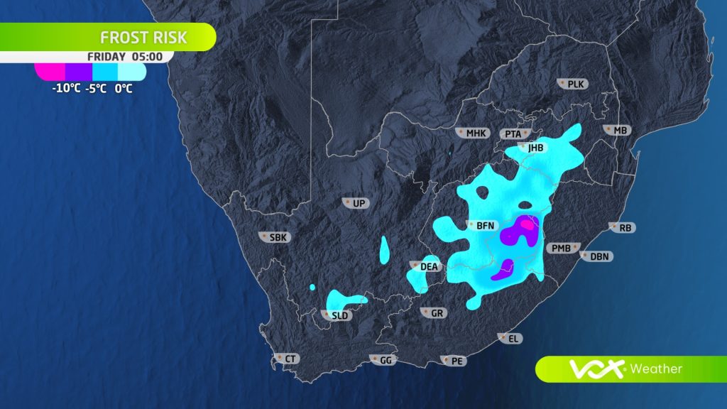
We’ve also seen widespread fog and frost over parts of the interior as temperatures hover around freezing point. These particular conditions can also affect business travellers through impaired visibility and more slippery or even closed roads, and potential damage to infrastructure from frost conditions.
Even businesses in parts of the country that experienced less extreme weather can be negatively affected. For example, rainfall in Gauteng in early June and again in July, while not as heavy as within the Eastern Cape or KwaZulu-Natal, would have potentially made the roads slicker, perhaps adding to the risk factors for motorists due to accidents and increased congestion.
As ever, Vox Weather is dedicated to bringing South Africans the latest weather updates to assist everyone across the country in planning their days and weeks.
For now, winter is in full swing and so the usual precautions – dress appropriately, travel with care, take shelter when necessary and carry out contingency planning as required – will apply.