Beyond the Forecast: Fire and Flood
The 2025 / 2026 fires in the Western Cape, followed by the May 2026 floods, brought absolute devastation to some parts of the province, reminding us of the power of nature when it’s fully unleashed.
Vox Weather Meteorologists Annette Botha and Michelle du Plessis set out in the Subaru Crosstrek, in another episode of their ongoing quest to go ‘beyond the forecast’ – this time to find out more about the recent weather-related disasters. You can watch the video here – the visuals are a sober reminder of the power of nature.
Both the Western Cape’s Provincial Government and its citizens are still recovering from the recent devastating fires and floods, which affected more than 231,000 people and severely damaged farms, roads and critical infrastructure. Sadly, some people also lost their lives during these extreme weather-related events.
Annette and Michelle decided to look at these two very different weather extremes: first came the intense fire season, which was then followed just a few months later by severe flooding. They set out in the Vox Weather Subaru Cross Trek to talk to some of the people who had experienced these weather extremes on the frontline.
And so we hear from a helicopter pilot who spends most of his working life fighting fires from the sky; a marine conservation photographer who filmed some of the aftermath of the floods in a gyrocopter; and a regional operations manager for the National Sea Rescue Institute (NSRI), who was involved in some of the rescues during the flooding. Their stories, both individually and together, are inspirational and heart-warming.
Starting with the Fire Season
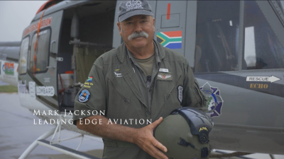
Hot, dry and windy conditions can very quickly turn a small fire into a deadly crisis. To understand what that looks like from the air, Annette and Michelle spoke to one of the fire pilots at Leading Edge Aviation, Mark Jackson, who runs the Lowveld-based company with his wife.
Mark explains: “We do a lot of aerial work, which includes some wildlife rescue work, but predominantly we’re involved in firefighting. For me, the defining feature of this recent fire season was how early and relentless it was. In 21 years of firefighting, I’ve never had to start so early.
“With the Gansbaai fires burning, our help was needed straight away. Working with our quick reaction force, we arranged to leave our normal base in the Lowveld and travel to the Western Cape to start suppressing those fires.
“From the first day, there were three solid ground teams, and the season never really slowed down from there.”
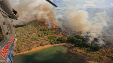
Mark clarifies that this fire season was more unpredictable and extreme than in recent years. He adds: “This was one of the busiest fire seasons I’ve seen. This was partly because we had very strong and warm berg winds. In this part of the country, they’re northerly winds that bring hot, dry air and this fire season, they were blowing at average speeds of around 40 to 50 kilometres an hour.
“These consistent winds were the strongest we’ve had in 30 years, and with winds like that, even the slightest ember or spot fire can blow up quickly, with the winds also, quite frequently, blowing all night. It helped to make the fire season unrelenting.”
Mark confirms that Leading Edge Aviation recorded 478 hours of firefighting and dropped about 8.2 million litres of water to quench the deadly fires.
He describes one particular moment that had an emotional impact on him, as follows: “We had a fire in the Wolseley–Tulbagh area that spread incredibly fast. It started next to a main road and was burning toward some wooden holiday cottages on flat ground. I circled overhead and signalled to the residents that the fire was coming. Watching people pack their belongings and leave in a hurry gave me goosebumps.
“We managed to put a line of water between the houses and the fire, and when we returned to refuel later, not one of those cottages had burned, and people were already putting their things back. It made the long distance we travel from home and the effort feel worthwhile!”
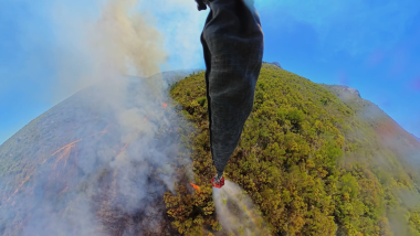
It’s incredible to think about the lives that Mark and his colleagues save – not only this year, but every fire season, due to the brave work they do in fighting the fires from the air.
From Dry Lands and Strong Winds to Saturated Grounds and Rising Rivers
After talking to Mark about the recent fires, Annette and Michelle then travelled in the Subaru Crosstrek to Morningstar Airfield near Cape Town to meet a pilot whose footage captured the flooding from the air.
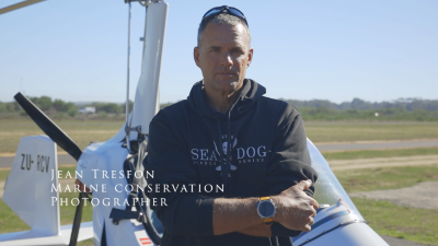
Jean Tresfon is a marine conservation photographer, pilot and cameraman who flew over the flooded areas recently. He shot footage from a gyrocopter – a type of small aircraft used for surveillance and aerial photography – to document the aftermath, which helped many people to see exactly how serious the flooding was.
Jean explains: “The main day of flooding took place the day before I could fly. By the time I flew the following day, the water levels had dropped a little, which actually made the damage easier to see. Buildings that had been underwater were now exposed, and the damage was shocking, with farm fields plastered with mud, and infrastructure and many buildings heavily damaged or completely destroyed.”
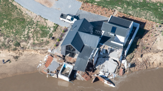
When comparing these floods to previous major Cape storms, Jean notes that, in terms of river height and the volume of water, this was the worst flooding since 1925. He says it’s plausible that the fire season contributed to the flooding, from the perspective of the fires burning through the vegetation that normally holds soil in place.
“When heavy rain falls soon after a fire, you get severe erosion. While the fires didn’t effectively contribute to the volume of water coming down the mountain, they certainly made the impacts worse, because vegetation and topsoil were washed away. For example, at Mitchell’s Pass near Ceres, the road was extensively damaged, with soil from burnt slopes coming down onto the road and nearby railway track, and so yes, in that sense, the recent fires played a role in the extent of the flooding.”
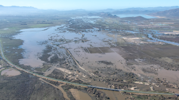
Jean notes that floods were common in the early 1900s and then rare for a while, and now we’ve seen notable events in 2008, 2023 and 2024, and again in 2026: “The pattern suggests these extremes are becoming more frequent, and the fires are definitely more prevalent than they used to be, and so preparation is more important than ever.”
It seems that we can’t pin a single storm or season directly on climate change, but we are seeing a more variable climate and more extreme events overall.
Rescue Operations During the Floods
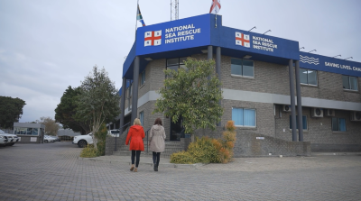
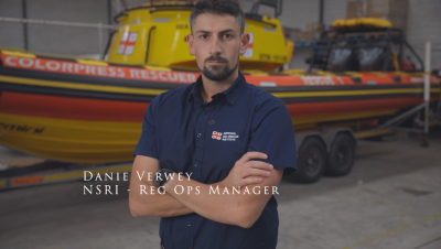
After listening to Jean’s information about the aerial views of the flooding, Annette and Michelle then went to the NSRI headquarters to learn more about how the recent flood rescue operations had unfolded on the ground. They spoke to Danie Verwey, who is one of the four regional operations managers for the National Sea Rescue Institute, and who reported that the rescue missions that took place were ‘hectic’.
Danie says: “After the heavy rainfall led to severe flooding across the Western Cape, volunteers and crews responded rapidly across multiple scenes. By the time we were activated, we already had several stations responding to call-outs throughout the day.
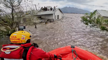
“One of the incidents people saw on social media was around Station 42, Kleinmond, responding in the Worcester and Rawsonville areas. The rescue crews really had to improvise: they couldn’t always reach casualties with boats, so they used anything they could find, including ladders, floating debris or anything that would get them to people stranded on roofs.”
Danie says there are many stories that stand out. “For example, in one case, crews scoped a house to see if anyone was trapped inside. They climbed onto the roof but couldn’t access the house through doors or windows because of the water, so they removed corrugated sheeting to enter from above.”
This kind of improvisation and bravery was common. If there is one main safety lesson for the public to learn from this event, it’s that if local authorities ask you to evacuate, you really should do so if you can!
Danie continues: “We know it’s not simple, and that you can’t always pack everything you love, but leaving when you’re advised to do so is usually the safest option. If you can’t reach higher ground, try at least to move out of the most affected area. Also, if you do evacuate, stick together in a group; it’s far easier for rescue teams to find groups than individuals.”
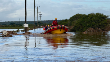
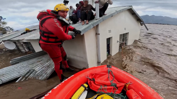
Annette notes: “From fire to flood, this all shows how quickly weather risks can change and how deeply they can affect lives, livelihoods and communities. That’s why we don’t stop at the forecast but instead aim to go beyond the forecast.”
Michelle concludes: “And from dry lands and strong winds, to flying over flooded fields and facilitating rescue missions, that’s another report from us on the harsh realities that the weather can help to unfold. We are thankful to Mark, Jean and Danie for sharing their experiences with us, as well as the incredible work that each of them does to share information and help to save lives.”