A sturdy and stylish Subaru Crosstrek is helping Vox Weather meteorologists Annette Botha and Michelle du Plessis reach remote and rugged locations more safely for storm and snow chasing, as well as their always-exciting ‘Beyond the Forecast’ episodes.

Vox Weather has entered into a partnership with Subaru Southern Africa, placing an impressive off-road-ready Subaru Crosstrek at the disposal of Annette and Michelle. The vehicle proudly carries Vox Weather branding on its doors, making it easily recognisable on the road and in Vox Weather content.

The partnership expands the team’s ability to report from remote and challenging locations, while improving safety for the presenters and crew members.

For Vox Weather, the car is more than just a marketing asset. It is a practical tool that changes what the team can do on location. Annette and Michelle enjoy filming outside broadcasts, storm and snow chases, and feature pieces for Vox Weather’s ‘Beyond the Forecast’ series. These segments can take the crew over gravel tracks, steep terrain and into adverse weather.

“Our horizon has expanded when it comes to storm and snow chasing, or any video concept that we want to shoot outside, because we now have the right vehicle to take us there,” says Annette.

She outlines the kinds of assignments the team can now tackle with greater confidence: “Michelle and I can go storm chasing and snow chasing during cold fronts in Cape Town this winter, and drive much more easily on gravel roads for our ‘Beyond the Forecast’ episodes,” she explains.

“We feel so safe in the Subaru Crosstrek. It allows us to embrace opportunities that previously would have required more caution, or might even have been beyond our scope. We are excited to think in ways that are a little more extreme and adventurous, because there is so much more that we can do now with the right vehicle to take us there.”

Subaru builds vehicles designed to give drivers confidence in all weather conditions, and the collaboration with Vox Weather is a great platform to show people the value of its technology, particularly the Symmetrical All-Wheel Drive system.

Annette adds: “The vehicle’s on-board modes also make it versatile. Drivers can choose settings tailored for light snow and gravel, or for mud and more extreme snowy conditions, allowing the car to adapt quickly to changing terrain without compromising on performance.”

She says Vox Weather will feature the vehicle in regular content, including short social reels, on-location intros and select ‘Beyond the Forecast’ episodes.

“We are so grateful to Subaru for trusting us with this Subaru Crosstrek and giving us the chance to take on more extreme and exciting adventures. This is more than just a vehicle. It is a partnership built for the road, for the elements and for the journey ahead, because when the weather changes, we move with it.

“Michelle and I feel confident in this car and safe, not to mention stylish, with the stunning Vox Weather branding combined with the vehicle’s Sand Dune Pearl colour. We look forward to driving in the rugged areas of our beautiful Western Cape. Don’t forget to hoot and wave if you see us!”

South Africa is one of the few countries in southern Africa that regularly has snow  – in places – in winter.

Vox Weather Meteorologist Michelle du Plessis tells us more.

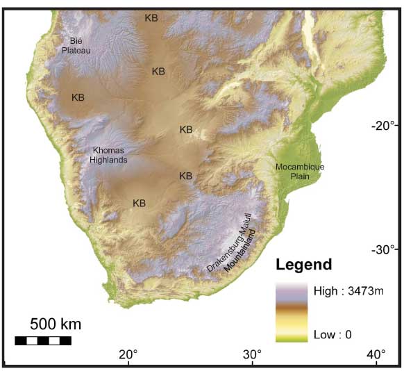
South Africa’s climatic diversity is largely due to its geographic position at the southernmost tip of Africa, where it’s influenced by both the warm Agulhas Current on the east coast and the cold Benguela Current on the west coast. Its varied topography – ranging from high plateaus to mountain ranges like the Drakensberg – creates conditions cold enough for snowfall in winter. Being the furthest south on the continent, South Africa is also directly affected by mid-latitude cyclones and cut-off low-pressure systems. When looking at our neighbouring countries, clear contrasts emerge in winter weather patterns.

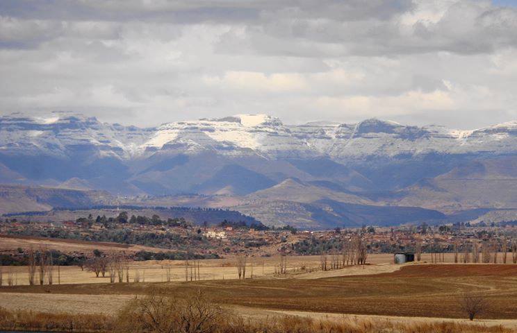
(Image left courtesy Mantle Plumes; Image right courtesy Vox Weather)

Lesotho, though an independent country, is entirely landlocked within South Africa.

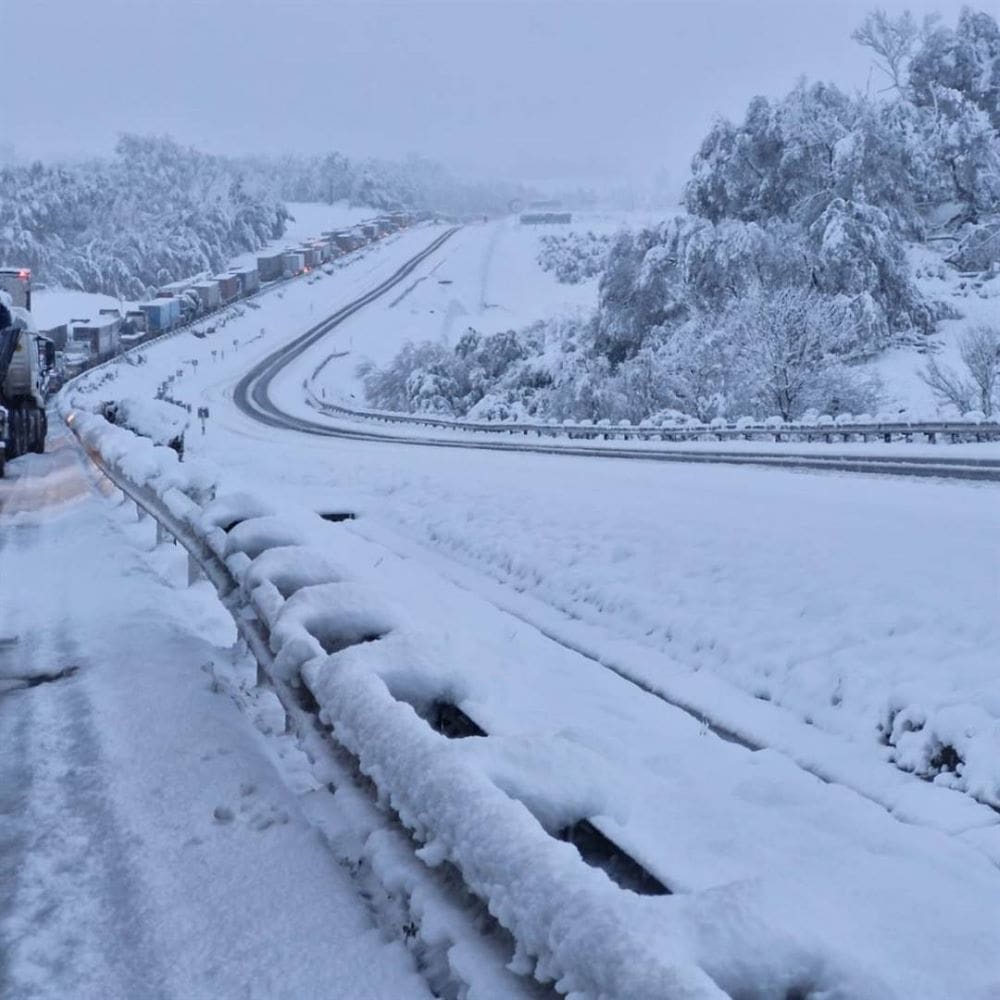
Its high elevation – most of the country lies above 1,800 metres – means it experiences regular snowfall in winter, particularly over the Maloti Mountains, much like surrounding high-lying areas of South Africa.

(Photo courtesy Snow Report SA / Marietjie Hayward)

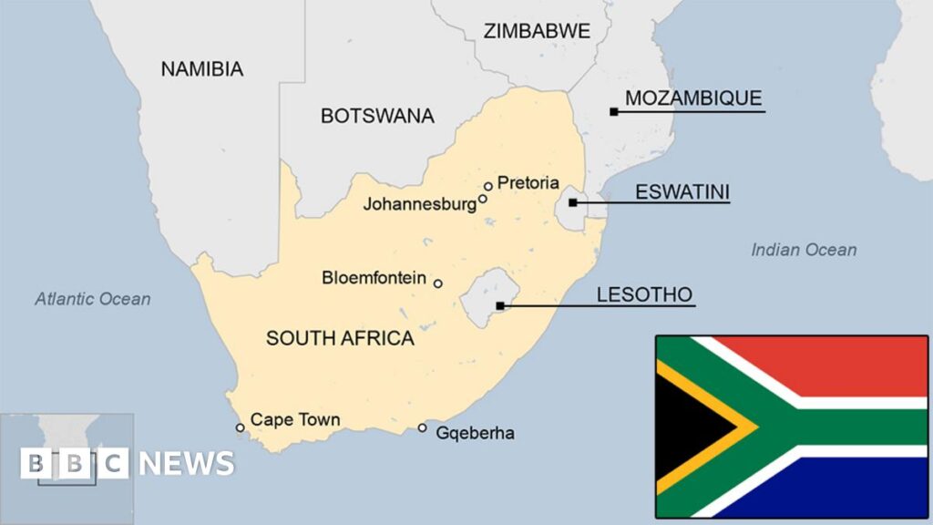
Namibia and Botswana experience dry, sunny winters with cool nights and warm days, but their generally low elevation and arid conditions make snowfall virtually impossible.

In Namibia, bergwinds or “oosweer” often bring warm, dry weather and occasional sandstorms as strong north-easterly winds prevail after the passage of cold fronts. Although rare, light snowfall can occur in the far south of Namibia when a particularly strong cold front moves unusually far north.

Zimbabwe and Mozambique have subtropical to tropical climates. Their winters are dry and mild, with average temperatures rarely dropping low enough to produce frost, let alone snow.

Eswatini experiences slightly cooler conditions in winter, especially in its highland areas, but snowfall is extremely rare due to its lower elevation and more humid climate.

(Map image courtesy of BBC News)

These regional differences highlight how South Africa’s southern location, combined with its topographical range and oceanic influences, makes it uniquely positioned to experience a wide variety of winter weather, including rain and snow – conditions seldom seen in its neighbouring countries.

(Click here to find out how snow weather occurs.)

Forecaster warned that snow is possible in central SA and Gauteng this week. Here is the latest weather update.

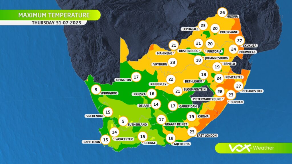
Snow in Gauteng? Weather models are pointing to a rare wintry mix for the province this Thursday as a powerful cut-off low sweeps across South Africa, bringing freezing temperatures and the potential for snow, hail, or graupel.

While actual snow settling in Gauteng remains unlikely due to higher ground temperatures, forecasters warn that conditions may be cold and unstable enough to produce soft hail or snow-like precipitation.

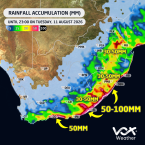
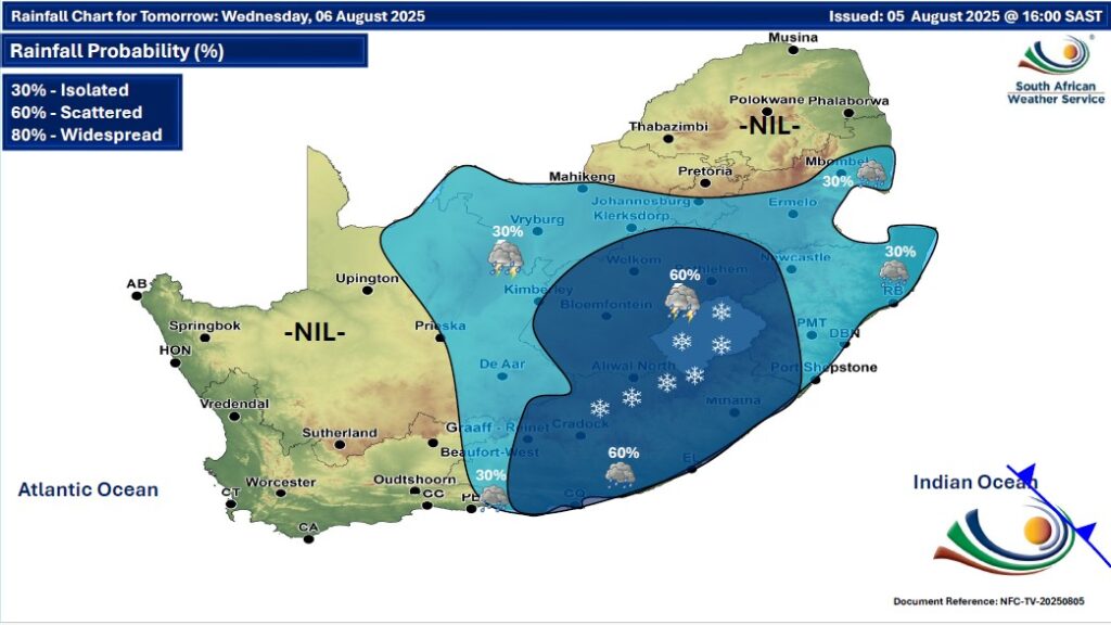
GARDEN ROUTE | KAROO NEWS – While snowfall is likely to evade Gauteng, a strong cut-off low will develop over the western part of the country on Wednesday and slowly move eastwards, spreading cold and wet weather over central and later eastern parts of South Africa. 

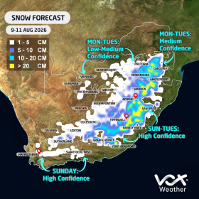
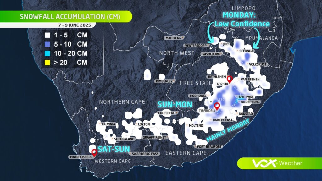
According to Vox Weather, models are indicating a mix of rain, snow, and graupel is likely over central South Africa (parts of Free State, Northern Cape, Eastern Cape, Lesotho). 

What is happening to SA’s winters and is climate change playing a significant role? Vox Meteorologist Michelle du Plessis tells us more.

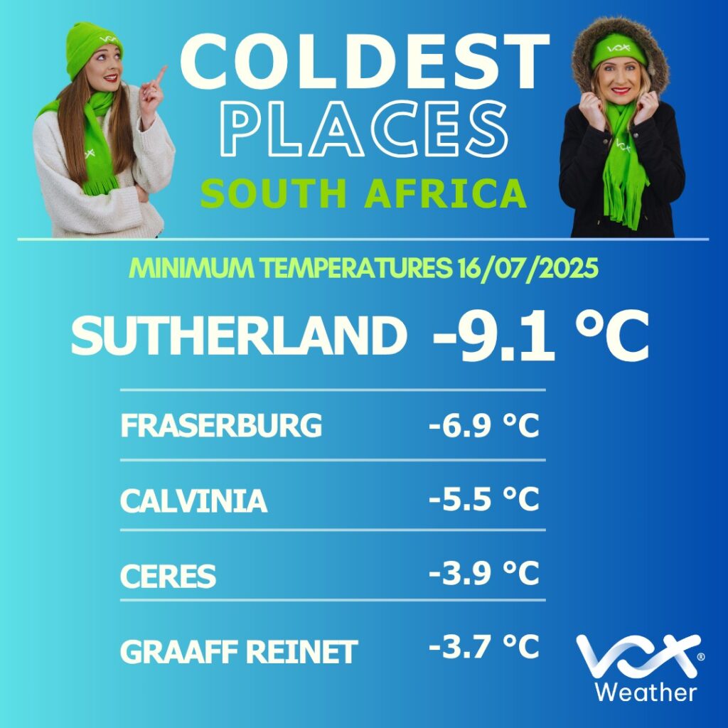
Data shows that winter temperatures across southern Africa have been steadily rising since the 1960s, with fewer days of frost and freezing conditions.

According to the NOAA, extreme cold events are now far less common – and when they do happen, they’re generally milder than in the past.

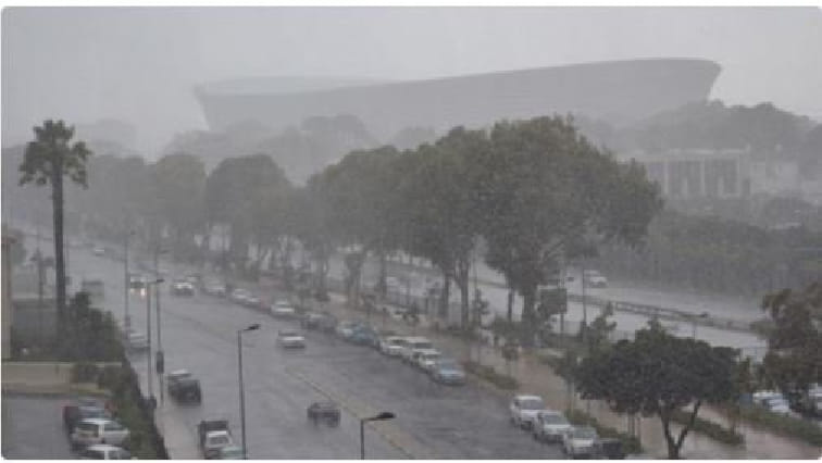
In the Western Cape, where winter rainfall is vital, climate models show that the rainy season is becoming shorter and more variable.

While some winters still bring strong cold fronts and good rainfall, others are marked by long dry spells.

The WMO warns that drought risks are increasing, especially in Mediterranean-type climates like the south-western Cape.

Interestingly, while total rainfall may decrease, when storms do occur, they may be more intense – bringing short bursts of heavy rain rather than steady soaking periods. This is because warmer air holds more moisture, which can lead to more powerful frontal systems when they develop.

Recent studies suggest that mid-latitude frontal systems – the cold fronts that bring winter rain – may grow stronger under climate change. However, this doesn’t mean we’ll get more of them. Instead, we may see fewer, but more intense, winter storms, followed by longer dry periods in between.

What this means for South Africa

In short, South African winters are becoming:

  • Warmer, with fewer frost days;
  • More variable, with rain falling in short, intense bursts; and
  • Less predictable, meaning long-range planning is harder.

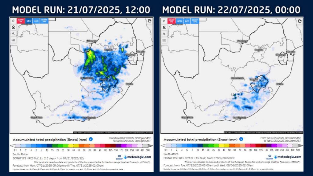
Some early snow forecasts recently circulated on social media suggested possible snowfall over parts of Gauteng, North West, the Highveld, and other areas that rarely experience snow during late July. At Vox Weather, we chose not to post about these projections – and here’s why.

Advanced snow forecasts, particularly more than five days ahead, are often subject to significant change. In fact, updated model guidance today NO LONGER indicates snowfall over these north-eastern regions at all.

Our approach as meteorologists to snow forecasting involves more than just looking at model snowfall outputs.

We analyse:

  • The SYNOPTIC SYSTEM expected (e.g. a cold front or cut-off low);
  • The availability and timing of PRECIPITATION; and
  • The FREEZING LEVELS (the altitude at which temperatures are cold enough for snow to form and reach the ground).

These factors must all align for snowfall to be possible. A shift in any of them can lead to significant changes in where snow may fall – or if it occurs at all.

As of the latest forecast, we see:

  • A cold front expected to move in on Friday 25 July.
  • A strong ridging high-pressure system to follow, introducing colder air over southern South Africa during the weekend of 26 and 27 July.
  • Forecast snowfall now largely restricted to the Eastern Cape, Lesotho, the southern Free State, and adjacent high-lying areas.

At Vox Weather, we prefer to wait until we see consistency in multiple forecast runs – usually within a five-day window – before communicating potential snowfall.


This ensures that our updates are as accurate and reliable as possible.

The arrival of snow isn’t an everyday occurrence for most of South Africa.

As we find ourselves back in snow season, we sat down with Vox Meteorologist Michelle du Plessis to give us the lowdown on how snow is formed.

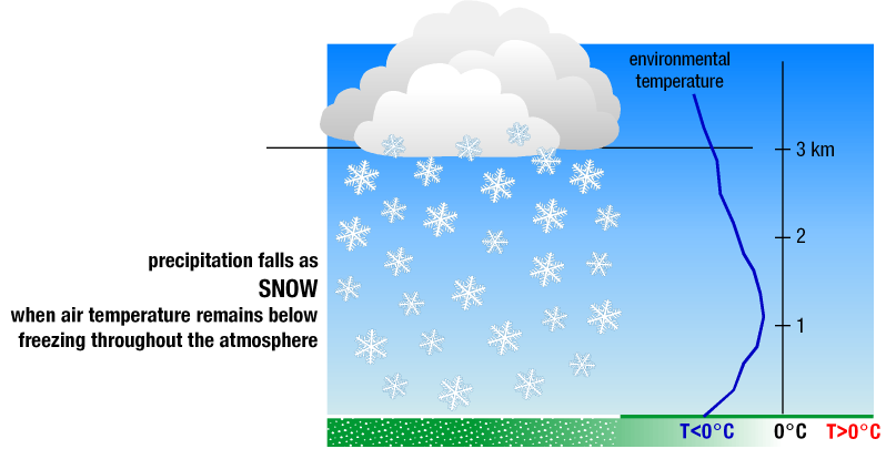
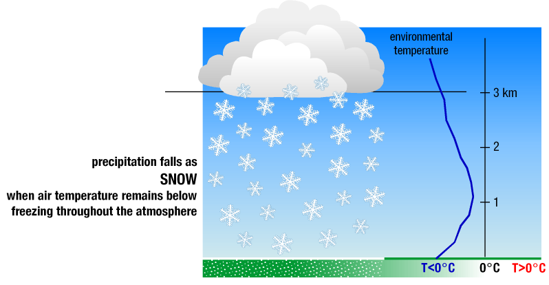
And it turns out that, for snow to fall and reach the ground, three main weather conditions must come together.

Cold air from top to bottom: The air must be below freezing (0 °C) all the way from the clouds to the ground. If there’s a warmer layer in between, the snow will melt and fall as rain or sleet. Ideal snow forms in clouds where temperatures are between -10 °C and -20 °C.

Enough moisture in the air: Cold air alone isn’t enough – you also need moisture so that water vapour can form ice crystals. Dry air, even if freezing, won’t produce snow.

Something to lift the air: Snow usually forms when air is forced to rise, cool, and condense. This can happen with cold fronts, low-pressure systems like cut-off lows, or when air is pushed up over mountains.

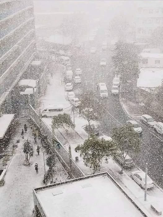
Gauteng’s last snowfall: July 2023…

In July 2023, Gauteng experienced rare snowfall – something locals hadn’t seen in over a decade (before 2023 it snowed in 2012 and 1996). While light snow sometimes falls in the province, heavier events like this happen only once every 10 to 20 years. So yes, it was unusual, but not unheard of.

The July 2023 cold snap wasn’t driven by climate change – instead, it was the result of a powerful cold front that swept across the entire country and extended into our neighbouring countries – supported by a steep upper-air trough, pushing icy air far north.

Looking ahead to winter 2025…

We find that the odds of another snowfall in Gauteng remain low. Climate trends suggest snow in the region will become even rarer in future. That said, nature still has surprises.

If the right weather patterns align—such as a strong cold front or cut-off low pressure system – we could see isolated snow again. But it would remain the exception, not the rule.