Seasonal Outlook: Winter 2026 Has Arrived After a Record-Breaking May
May 2026 will always be remembered as being one of the most remarkable weather months in recent Western Cape and Southern Cape history. Vox Weather Meteorologist Michelle du Plessis shares the seasonal outlook for winter 2026.
Please note: All graphs and images are taken from the latest Langtermyn Landbou-Weervoorspelling, and you can also view the current seasonal Landbou show here.
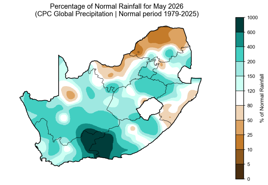
The percentage of normal rainfall for May 2026 clearly shows just how unusual the month was. Large parts of the southern half of South Africa received above-normal rainfall, but the most extreme values were concentrated over the Southern Cape and parts of the Western Cape, where rainfall exceeded 400%, 600% and even 1,000% of normal in places. This means some areas received several times more rain than they would usually expect during May.
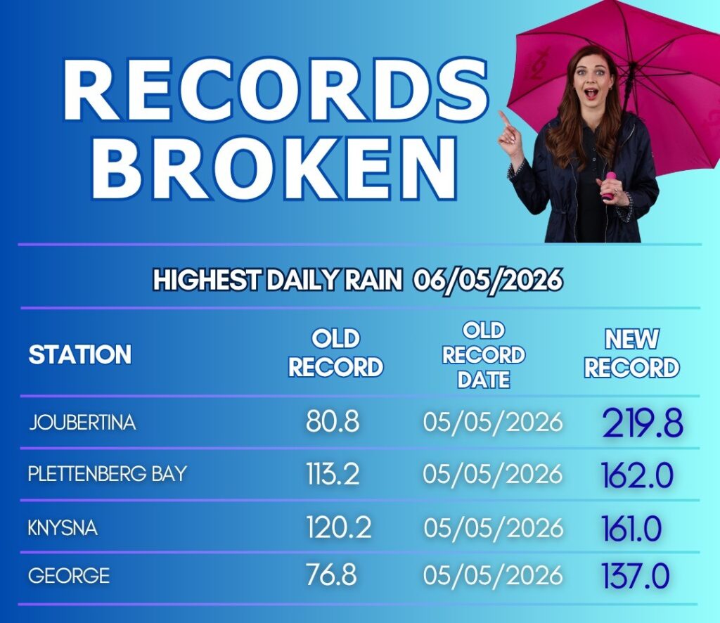
This exceptional rainfall was mainly driven by two major weather events. The first was a powerful cut-off low at the beginning of the month, which brought exceptional rainfall to the Southern Cape and Langkloof. Joubertina recorded 220 mm in 24 hours, while one Bokmakierie Holdings weather station in the Krakeelrivier region measured more than 1,000 mm during the event. The flooding around Krakeelrivier was described as some of the worst on record, with experts calling it a one-in-100-year rainfall event.
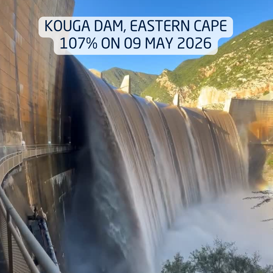
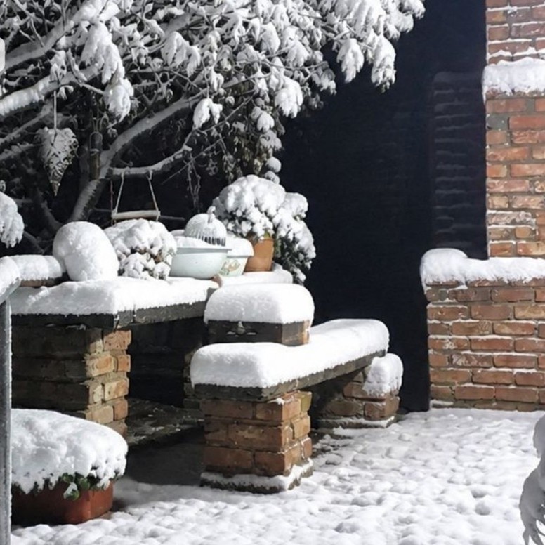
This system also caused dramatic dam level rises, with several dams recovering rapidly. Kouga Dam overflowed on 7 May, showing just how widespread and intense the rainfall was. Very cold air behind the system also brought widespread snow to parts of the Karoo and higher-lying areas.

The second major event followed shortly afterwards, when two strong cold fronts reached the Western Cape from 10 May. Ceres recorded 333.2 mm of rain in 24 hours on 11 May, breaking its highest daily rainfall record since measurements began in 1955. Ceres normally receives around 80 mm of rain during May, but by the end of the month, more than 500 mm had been recorded. This means the town received more than six times its normal May rainfall.
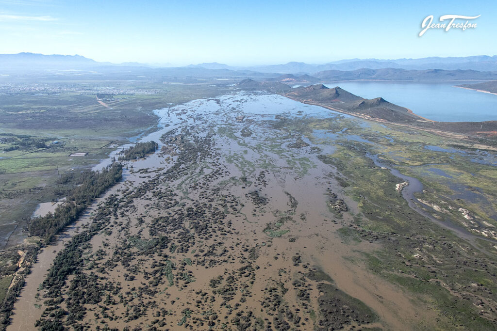
Runoff from the mountains caused the Breede River to rise rapidly. The flood levels recorded near Swellendam suggest that this was likely one of the largest Breede River floods in more than a century, and possibly the biggest since 1925.
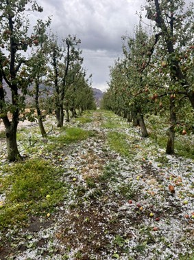
Approaching Brandvlei Dam, the Breede River expanded to more than 1 km wide (above left). At the Diepsak Farm area there was massive damage to the farmlands, with whole orchards still underwater (above right).
Together, these two events defined May 2026: a month of broken rainfall records, historic flooding, rapid dam recovery and widespread snow.
ENSO Outlook
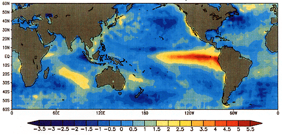
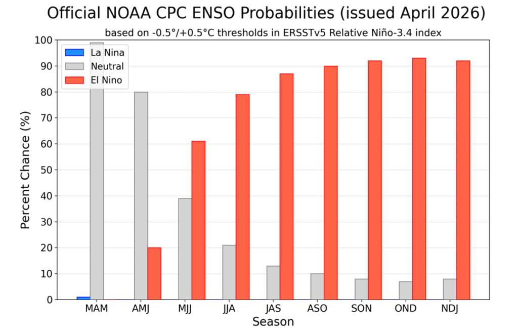
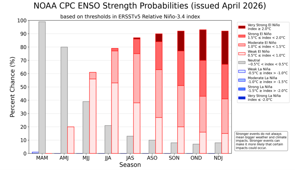
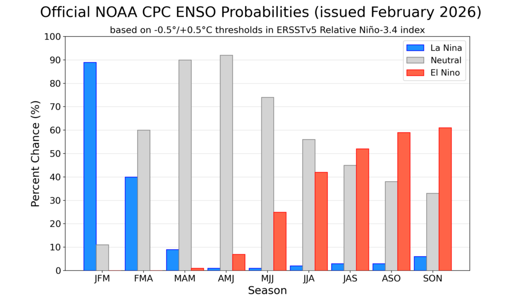
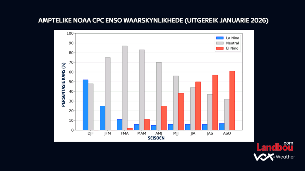
We are currently still in ENSO-neutral conditions, but the latest ENSO probability forecast from the National Oceanic and Atmospheric Adminstration (NOOA), the US government’s official national weather service, is showing a strong signal for El Niño development later this year.
According to the forecast, there is an 82% chance of El Niño conditions developing during May to July, increasing to an almost 100% chance by spring.
The NOAA ENSO strength forecast also shows a notable signal for a stronger event later in the year. For the November 2026 to January 2027 period, it indicates about a 1-in-3 chance of a strong El Niño developing, and another 1-in-3 chance of a very strong El Niño developing. Combined, this suggests roughly a 2-in-3 chance of either a strong or very strong El Niño during that period.
So, while the signal for El Niño is currently very strong, it is important to remember that this is not a direct drought forecast. Local rainfall patterns are also influenced by many other factors.
For now, the key message is to keep a close eye on how the forecast develops over the coming months. Seasonal guidance is useful, but shorter-term forecasts will remain especially important when it comes to planning around rainfall, agriculture and water risks.
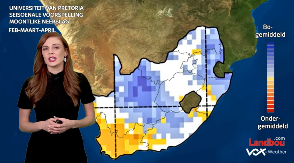
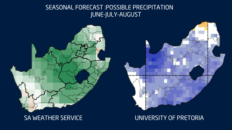
Seasonal Outlook: June, July, August (Winter)
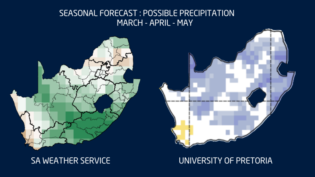
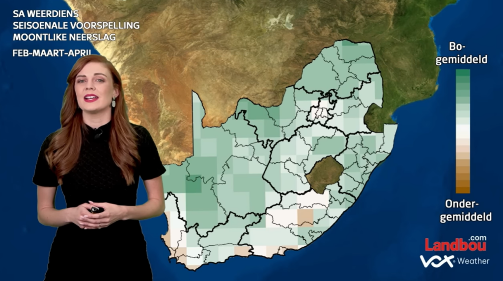
The seasonal precipitation outlook for June, July and August shows a broadly similar picture from both the SA Weather Service and the University of Pretoria. Both forecasts indicate enhanced probabilities for above-normal rainfall across large parts of the summer rainfall region during winter, especially over the central and eastern interior. This suggests that parts of the country that are usually drier during winter could still receive some rainfall during this period.
The winter rainfall region, however, does not show the same strong or consistent signal. While some areas may still receive frontal rainfall during the season, the outlook does not point to a clear, widespread above-normal rainfall signal over the south-western Cape.
Overall, the two forecasts support a similar broad message: a wetter-than-usual winter signal over much of the summer rainfall region, with more uncertainty over the winter rainfall region.
Seasonal Outlook: August, September, October (Spring)
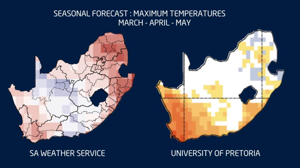
When looking at the late winter to early spring seasonal outlook for August, September and October, the two forecasts start to show more noticeable differences.
The SA Weather Service forecast still indicates a wetter signal across large parts of the interior, especially over the central parts of South Africa. However, the University of Pretoria forecast shows a more mixed picture, with indications of drier conditions over parts of the west and east, while some areas along the east coast still show a wetter signal.
This difference between the two forecasts highlights the uncertainty that remains for the late winter and early spring period. This is especially important as El Niño is expected to develop later this year, which could influence rainfall patterns as we move closer to spring and summer.
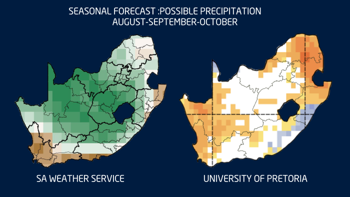
For now, the key message is that the seasonal signal is not yet fully consistent. It remains important to monitor the forecast closely over the coming months and to use shorter-term forecasts for more detailed planning.
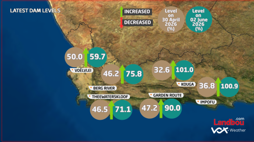
Latest Dam Levels
The impact of the May rainfall was also clearly reflected in dam levels across the Western and Southern Cape.
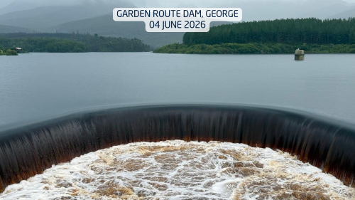
By 2 June 2026, several major dams had shown dramatic increases compared to the end of April. The Kouga Dam rose from 32.6% to 101.0%, while the Impofu Dam increased from 36.8% to 100.9%. The Garden Route Dam also climbed sharply from 47.2% to 90.0%.
Further west, Theewaterskloof Dam increased from 46.5% to 71.1%, Berg River Dam from 46.2% to 75.8%, and Voëlvlei Dam from 50.0% to 59.7%.
These increases show just how significant the rainfall was during May. While the flooding caused severe damage in many areas, it also brought a major turnaround for several dam systems that had been under pressure earlier in the year.