Spring has arrived, bringing with it a new long-term agricultural weather outlook for South Africa. We once again look forward to the new season, as well as taking a quick look back on the winter that is now officially behind us.

Vox Weather Meteorologist Michelle du Plessis tells us more.

While parts of the country have already seen a wetter start to the season at the beginning of September, especially across the central and eastern regions, attention is increasingly turning to the strengthening El Niño and what it could mean for the coming summer.

Before looking ahead, however, it’s worth reflecting on a winter that was exceptionally dry across parts of the west.
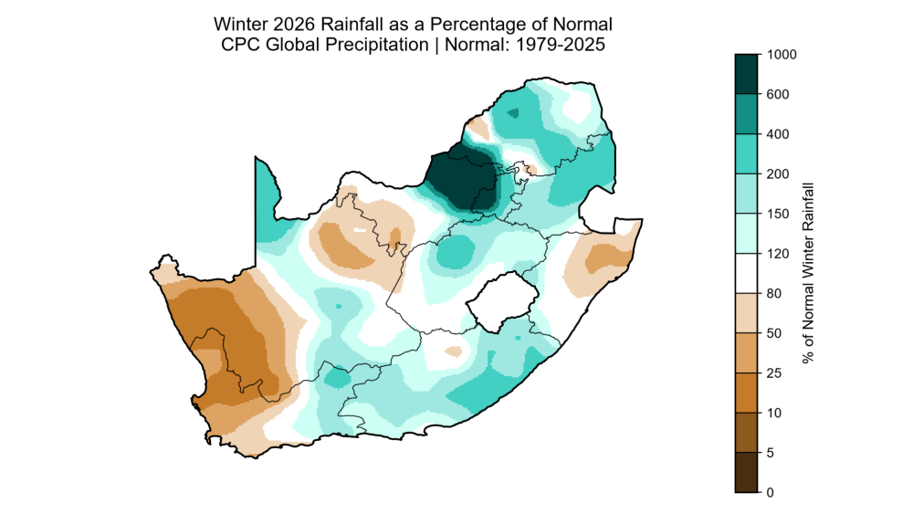
A Notably Dry Winter In the West

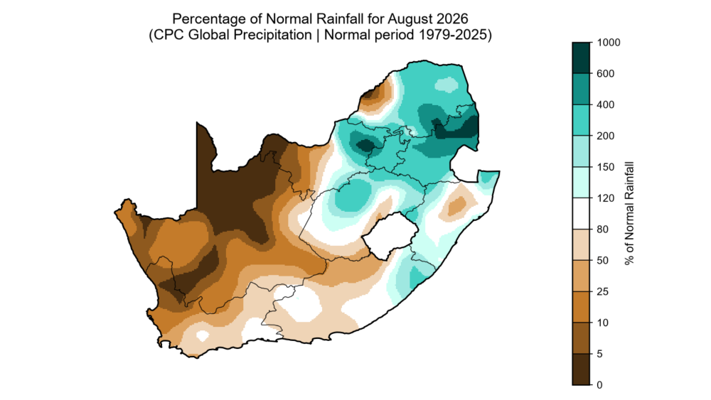
Large parts of the Northern Cape and western interior experienced an exceptionally dry August, with some areas receiving only around 25% of their normal rainfall for the month, and locally even less.

This is particularly significant for the winter rainfall region, where August still forms an important part of the traditional rainy season.

Further east, the picture was very different. A cut-off low brought widespread rainfall to parts of the country and was also responsible for some of the coldest conditions of the winter, including widespread snowfall.
 

Because August is normally a dry month across much of South Africa’s summer rainfall region, a single significant weather system can have a major impact on monthly rainfall totals.

Looking at winter 2026 as a whole, the strongest dry signal was concentrated across the western parts of the country.

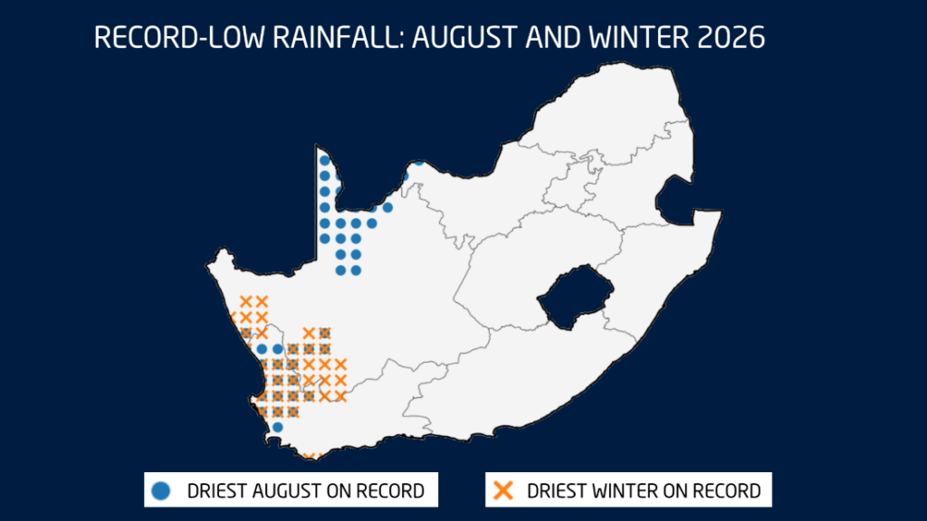
Large areas of the western Northern Cape, including parts of Namaqualand and the West Coast, experienced a very dry season, with some locations recording one of their driest winters on record.

Record-low rainfall was particularly evident across parts of the Northern and Western Cape, with several locations recording either their driest August or driest winter on record.
Winter was also unusually warm

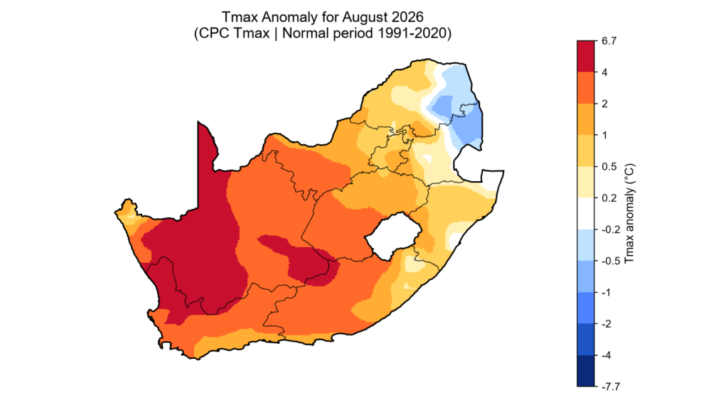
The winter was not only dry in many western areas, but also unusually warm.

Analysis indicates that temperatures were between 2°C and 4°C above normal across large parts of the Northern Cape, as well as portions of the Western Cape, North West, Free State and northern Eastern Cape.

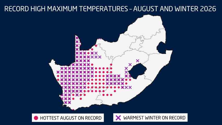
Several locations recorded their warmest August on record, while others experienced their warmest winter on record.

The strongest concentration of record warmth was found across the Northern Cape and western parts of the Western Cape, although records were also observed in parts of the Eastern Cape and Free State.

A Wet and Unsettled Start to September

The first week of September brought a sharp change in conditions, with a strong cut-off low developing over the country.

Cold, wet and windy weather occurred across several provinces, with heavy rainfall over parts of North West, the Northern Cape and Free State.

Rain also occurred across parts of the Karoo, the south coast, Eastern Cape, KwaZulu-Natal and Lesotho, while some rainfall extended as far north as Gauteng, Limpopo and the Highveld.

The heaviest falls fell over the central North West and neighbouring parts of the Northern Cape and Free State, with accumulated rainfall approaching 100 mm in some areas by Sunday evening 06 September, which raised the risk of flooding.

Could September Bring a Wetter Overall Start To Spring?

Seasonal guidance suggests that wetter-than-normal conditions may continue across parts of central and eastern South Africa during the first half of September. Above-normal rainfall is possible over eastern parts of the country during the second week of the month, with the wetter signal continuing across sections of the central and eastern regions into the third week.

By the final week of September,  the pattern becomes more mixed, with below-normal rainfall possible along parts of the south and east coasts, while wetter conditions may occur across Limpopo, North West, the Northern Cape, Eastern Cape and Free State.

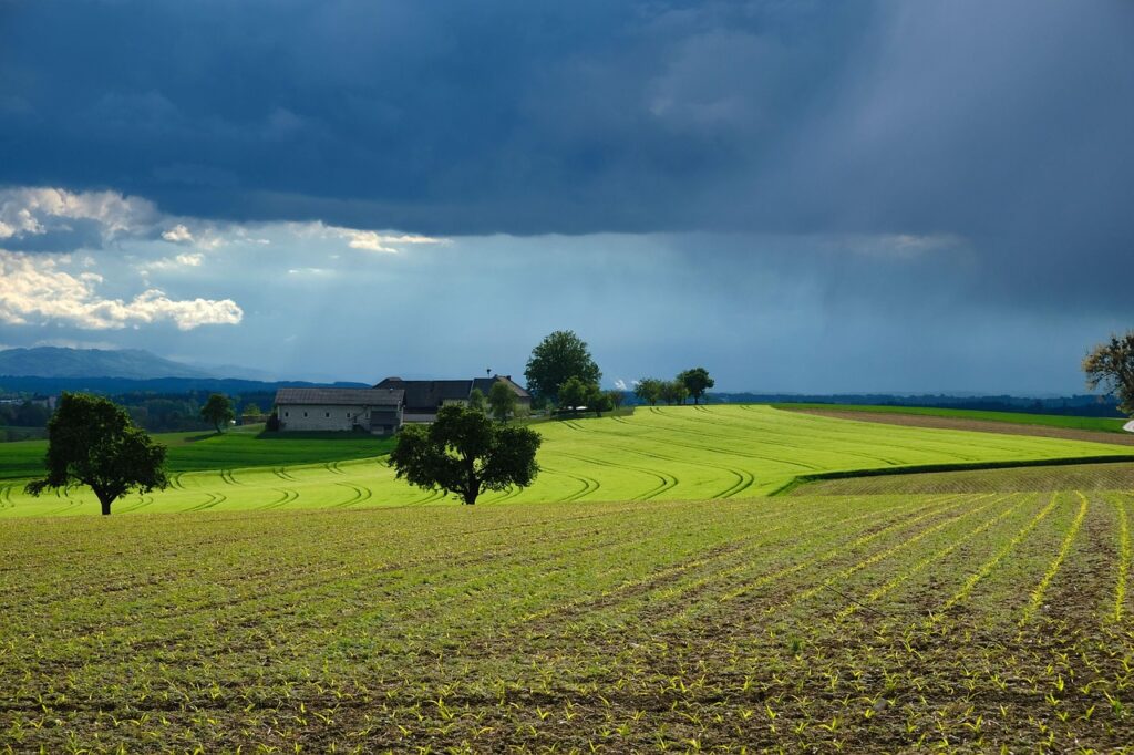
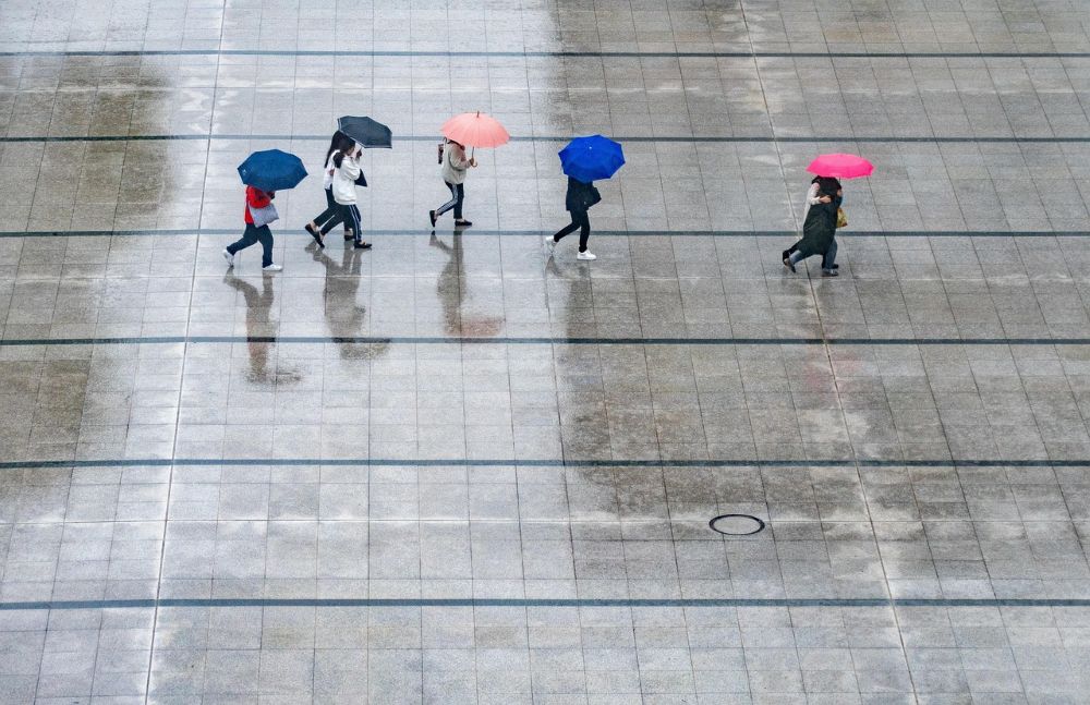
It’s important to remember that spring is a transition season. As atmospheric instability increases, thunderstorms can become more intense, bringing not only heavy rain, but also hail and strong wind gusts.
El Niño continues to strengthen

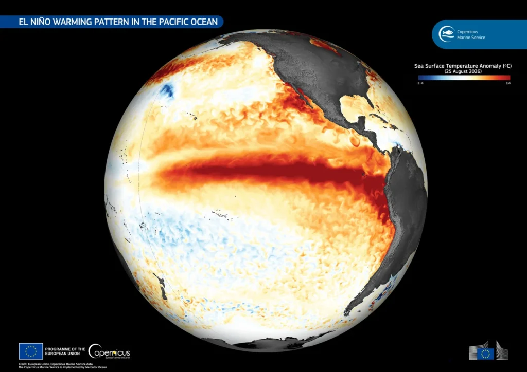
El Niño has strengthened further in recent weeks and is now firmly established. The latest relative Niño 3.4 index stands at around +2.45°C, while seasonal models indicate that further strengthening is possible through spring.

There are even indications that this event could reach exceptionally strong levels.

For South Africa, El Niño is typically associated with an increased risk of warmer and drier conditions across the summer rainfall region, particularly later in the season. However, El Niño does not automatically mean drought.

There can still be periods of significant rainfall, and individual weather systems can bring substantial rain even during an otherwise dry season. (Image: Wikipedia)
Spring rainfall outlook remains uncertain

The latest seasonal forecasts currently provide mixed signals for spring.

The South African Weather Service indicates an increased chance of above-normal rainfall across parts of the Northern Cape, Free State, Eastern Cape, KwaZulu-Natal and Highveld during the September-to-November period.

The University of Pretoria outlook, however, paints a different picture, indicating below-normal rainfall across large parts of the country.
 

Forecast skill for spring rainfall remains relatively weak, meaning confidence in these rainfall projections is still low. For now, considerable uncertainty remains around exactly how the spring rainfall season will unfold.


Exciting news for Spring Day!

Subaru Southern Africa has extended its partnership with the Vox Weather team and has presented a second Subaru Crosstrek to the Vox Weather Meteorologist team of Annette Botha and Michelle du Plessis. The strengthened Subaru sponsorship officially kicks off today: Spring Day, 1 September 2026!

This means that Michelle will drive the new off-road-ready vehicle, while Annette will drive the first Crosstrek that was previously and generously gifted. Both cars share the same specs; they just come in different, beautiful colours.

Annette’s ‘Blitzy’, the original Vox Weather Crosstrek, is in eye-catching ‘sand‑dune’, and Michelle’s new ‘Breezy’ is a bright and bold lime green. The new vehicle will also proudly carry Vox Weather branding on its doors, making it easily recognisable on the road and in Vox Weather content.

For the Vox Weather ladies, the cars are more than just a marketing asset, representing practical tools that change where they can go on location for stories, many of which can take the presenters – and their television crew members – into adverse weather and over gravel tracks and steep terrain. The partnership expands the team’s ability to report from remote and challenging locations, while improving safety for everyone involved.

Subaru builds vehicles designed to give drivers confidence in all weather conditions, and the collaboration with Vox Weather is a great platform to show people the value of its technology, particularly the Symmetrical All-Wheel Drive system.

Michelle comments: “We’re especially excited because the second Crosstrek gives Vox Weather greater flexibility on the road.

“Whether we’re covering coastal sea‑breezes, inland heatwaves or community stories in remote corners, we can now head out in matching cars with different colours but enjoying the same performance!

“The Crosstrek’s all‑round ability suits our adventurous on‑location work, offering reliable handling, generous cargo for kit and cameras, and the ease of getting into places that matter for our viewers.”

Annette adds: “At Vox Weather we’re proud to work with partners who help us deliver improved coverage from the field. The second Crosstrek continues to help us in reaching viewers, responding to breaking conditions and bringing practical, local weather information to local communities.”

In the image on the left, Michelle receives the keys from Anton Brewer, of Reeds Bellville.

As an additional bonus to the partnership, Subaru is also coming on board as an anchor sponsor of Vox Weather’s daily weather shows, which go out every evening and then also feature the next morning on Die Groot Ontbyt, on kykNET.

This means that viewers will see the Subaru name across the evening bulletin and the breakfast highlights, in a partnership that brings real‑world mobility to Michelle and Annette, and visibility to Subaru across two prime time slots.

So watch the evening shows, catch the highlights on Die Groot Ontbyt the next morning, and keep an eye on Vox Weather’s social channels for fresh photos of Michelle’s lime‑green Crosstrek and Annette’s sand‑dune ride. Here’s to more road trips, better weather coverage and a strengthened partnership with Subaru.

Oh, and a happy Spring Day, South Africa! We wish you a beautiful season of new life and energy renewal!

Spring is a season of colour, new life and renewed energy and enthusiasm, but when does it actually begin? Is it on the first of September, or the day the Sun crosses the equator near the September Equinox, which is usually around the 21st of that month?

Let’s find out – and also get a sneak preview of the weather forecast for next week, when the clock ticks over to a new month, and a new season.

So when exactly does spring officially begin – on the first or the twenty-first of September?

The short answer is ‘both’, because different meteorological and cultural traditions mark spring in different ways.

In the country that we love to call ‘Sunny South Africa’, we make sure that spring officially starts as early as possible! and so we mark it on the first of September.

And so, with winter officially almost at an end, let’s take a look at some of the ways people celebrate spring around the world, and then check out an early weather forecast for next week from Vox Weather Meteorologist, Michelle du Plessis.

Two Ways to Mark Spring: Meteorological vs Astronomical

Meteorological spring is simple: it runs from 1 September to 30 November in the southern hemisphere. Many weather services use this definition because it groups months with similar temperatures and makes climate statistics easier to compare.

Astronomical spring begins at the September Equinox, late in the month, when the Sun crosses the celestial equator.

Both are valid: meteorological spring gives us a neat calendar start, while astronomical Spring ties the season to the Sun’s position at the Equinox (around 22–23 September).

Equi-What? No, Equinox…

The September Equinox is a seasonal milestone in Earth’s yearly orbit around the sun. The Equinoxes – in March and September – happen when the Sun sits directly above Earth’s equator, causing day and night to be nearly equal in length across the globe. The word comes from the Latin aequus (equal) and nox (night). 

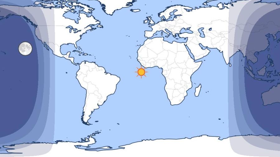
For the southern hemisphere, the September Equinox marks astronomical spring; for the northern hemisphere it marks astronomical autumn. At the September Equinox, the sun’s position relative to the Earth is moving from north to south as it crosses above the equator. It’s bringing summer to the Southern Hemisphere and winter to the Northern Hemisphere.

The image above shows the illustrative position of the sun at the September Equinox, moving away from the northern hemisphere and into the southern hemisphere (image courtesy of timeanddate.com).

Because the exact timing depends on Earth’s orbit and leap‑year adjustments, the Equinox date can shift slightly from year to year. The September Equinox usually falls on 22 or 23 September each year (occasionally the calendar can push it to the 21st or 24th).

The 2026 September Equinox will fall on 23 September – which is when spring 2026 will officially begin for those countries that choose to celebrate the start of spring with the Equinox.

How Do South Africans Celebrate Spring’s Arrival?

Whether a nation chooses to celebrate the arrival of spring on the first of September or at the September Equinox, the new season’s arrival usually comes with a sense of energy and happiness!

Here in South Africa, we find people in workplaces and especially schools welcoming the new season with commemorations that highlight flowers and nature. Particularly in pre-primary and primary schools around the country, children and their teachers might have flower shows, plant seeds, enjoy outdoor picnics and make flower-themed crowns and pictures during art lessons.

South Africans also celebrate spring by exploring the wildflower blooms in the Western Cape and Namaqualand and within urban parks; going whale watching along the coast, especially the Western Cape coastline; or having an outdoor braai.

Nature’s gorgeous displays of indigenous flowers in full bloom in the Cape and Namaqualand follow the rains and can peak later in the season.

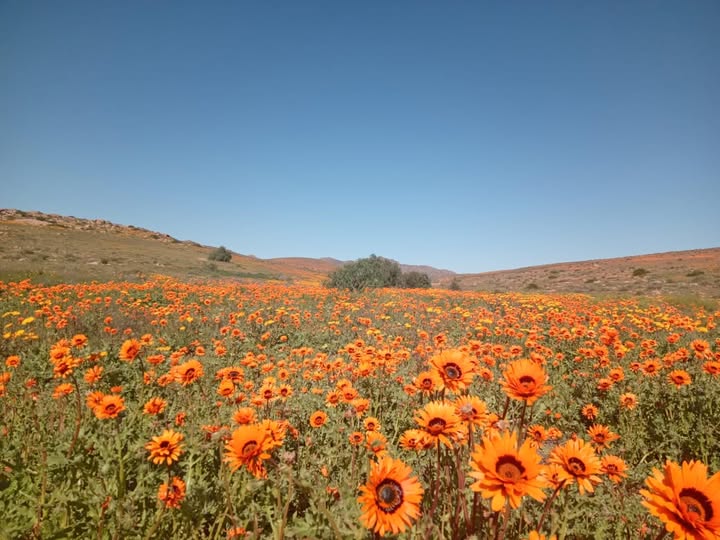
A highlight includes the Namaqualand wildflowers, which is a stunning floral display that usually takes place from August to September, sometimes later depending on winter rainfall. It’s one of South Africa’s most famous spring spectacles – tourists come from around the world to see the flowers.

Click here to link to the recent visit by Michelle and her fellow Vox Weather Meteorologist Annette Botha, when they explored the Namaqualand flowers earlier this month!

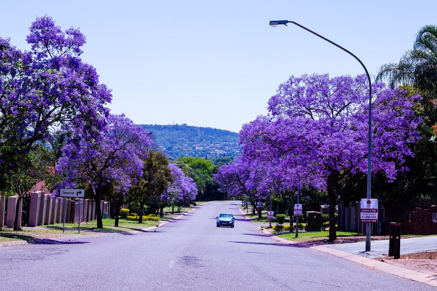
Although they aren’t indigenous, the Jacaranda trees in Johannesburg and Pretoria are also famous and well-loved during spring and early summer, with their canopy of purple blossoms bringing a beautiful purple sheen to uplift the suburbs.

When the sun comes out, so do South Africans! You can find people visiting markets and parks with gusto and enjoying the famous local outdoor cuisine event that is the ‘braai’ or ‘shisanyama’.

However you choose to celebrate spring day in South Africa, we hope that the weather will be kind… more on this lower down.

Spring in Other Parts of the Southern Hemisphere

The Australian Bureau of Meteorology also treats 1 September as the start of spring, and Australia celebrates Wattle Day every year on the first of September, to mark the official first day of spring and honour the golden wattle (Acacia pycnantha) as the national floral emblem.

Similarly, New Zealand also widely uses 1 September as the season’s start there too. Major cultural events often happen throughout the spring season, into October and November as well, including flower festivals and the Melbourne Spring Racing Carnival, which is an elite thoroughbred horse racing and social season held annually from August through November.


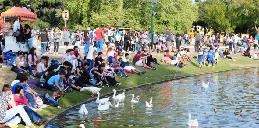
In the South American countries of Argentina, Chile, Uruguay and parts of Paraguay, spring celebrations tend to cluster around 21 September, which sits close to the Equinox. Argentina’s Día de la Primavera (Spring Day) and Student Day on 21 September are big social events, with picnics and student gatherings filling the day (as shown in the image on the right).

Brazil marks tree‑related events such as Arbor Day on 21 September as well, aligning with ecological themes at the start of spring.

Springtime North of the Equator

The northern hemisphere spring is mostly celebrated from March to May, with the March Equinox (20–21 March) marking astronomical spring. Some traditions include the following:

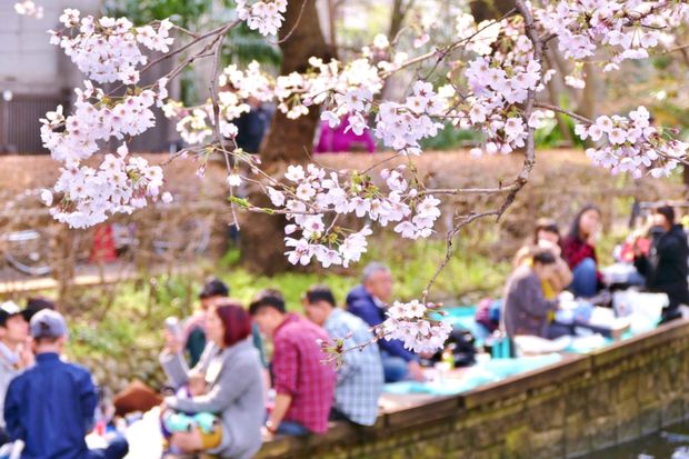
  • Japan: Cherry‑blossom festivals (named hanami) in March celebrate the arrival of spring with picnics under the trees (as shown in the image to the right, courtesy of exploreworldwide.com).
  • India: Holi, which is a colourful festival of spring and love, usually falls in March and brings public gatherings, music and the throwing of coloured powders.
  • Europe and North America: May Day, Easter and local flower and garden festivals celebrate spring through different customs and dates.

Spring Day Weather Outlook – 1 September

Is it time to put away the winter layers for the rest of 2026?

Michelle has the following update on the weather forecast for the first week of September, when spring is officially here!

Spring Day is looking fairly typical of the season across South Africa, with warm conditions over much of the interior, cooler weather along the southern and western coast, and a chance of isolated thunderstorms.

Temperatures across the interior are expected to reach the mid to upper 20s, with parts of the western and northern interior possibly reaching around 30°C.

A cold front will approach the country from the west. Ahead of the front, increasing instability could create favourable conditions for isolated thunderstorm development over parts of the interior during the afternoon and evening.

The southern and western coastal areas will remain noticeably cooler, with maximum temperatures generally in the upper teens to low 20s.

Some expected maximum temperatures:

  • Cape Town: 18°C
  • Gqeberha: 21°C
  • Durban: 23°C
  • Mbombela: 24°C
  • Johannesburg: 27°C
  • Pretoria: 29°C
  • Bloemfontein: 28°C
  • Kimberley: 30°C

Overall, much of the interior should get a warm taste of spring, while the coast remains cooler. And in typical spring fashion, a few isolated thunderstorms may also make an appearance.


Spring can be a precise astronomical moment, a neat meteorological month or a loosely defined cultural season.

Wherever you are in South Africa, and however you choose to define it, spring is a great excuse to get outside in our beautiful land and see wildflowers, plant trees, join a picnic or simply enjoy milder weather after the end of winter.

As spring 2026 unfolds, don’t forget to follow Vox Weather for up‑to‑date spring forecasts – enjoy the season!

Did you ever notice how the increased winds in August in South Africa’s interior are closely linked to the seasonal transition from winter to spring?

Vox Weather Meteorologist Michelle du Plessis tells us more.

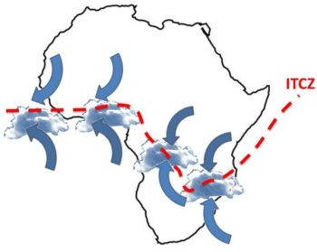
During winter, much of South Africa is dominated by a stable high-pressure system over the interior. By late winter, this high-pressure system begins shifting as the Intertropical Convergence Zone (ITCZ) also moves further south, while cold fronts from the southwest continue to pass across the country.

The interaction between these different air masses, namely colder, denser air from the west and warmer, lighter air building over the interior, creates a tighter pressure gradient. A tighter pressure gradient causes air to move faster, which is experienced as stronger winds. 

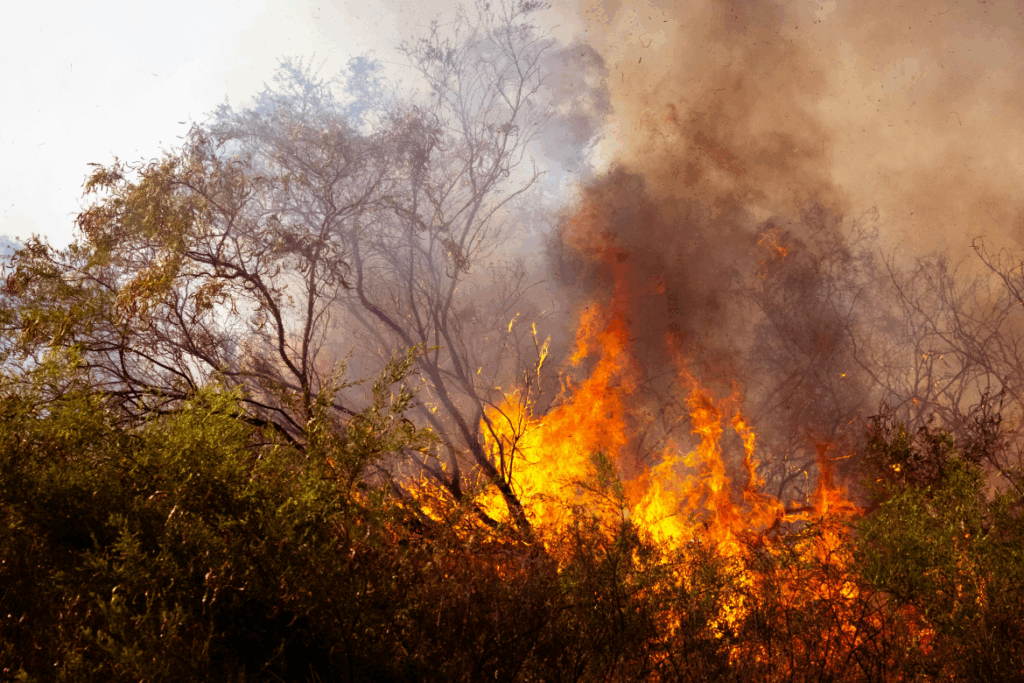
At this time of year, vegetation and soils are generally at their driest after months of limited rainfall. This allows dust and sand to be lifted more easily by the wind, and also creates ideal fuel for fires. The combination of dry vegetation, low humidity and strong winds makes it far easier for flames to spread rapidly and become uncontrollable. 

These conditions are a key reason why August is one of the worst times for any open burning, as even a small spark can quickly escalate into a runaway wildfire.

When Will the Rains Come?

The ‘August winds’ is generally a late‑winter feature that usually builds from late July, peaks through August, and fades during early to mid‑September. Mechanistically, the windiness is driven because of strengthening pressure gradients between lingering cold fronts to the southwest and a warming interior.

In most years, the interior’s first spring showers arrive mid to late September, but they’re usually light and isolated. The true start of the rainy season, with consistent, useful rainfall, tends to occur from October into early November.

Recent research confirms a shift toward a later onset of rain, especially in Gauteng and surrounding areas. What was once expected in September now often only establishes in October or even November.

This trend is linked to climate change and ENSO cycles, with El Niño years delaying rain and La Niña favouring earlier onset.

The bottom line is that the spring rains are coming, but they’re running later than they used to.

As the frontal influence relax and low‑level moisture flux from the northeast strengthens, winds generally ease from their late‑winter peaks and thunderstorm days begin to appear.

A practical rule of thumb is a one to four week overlap or transition: the gusty late‑winter pattern tapers off in early to mid-September; the first weak convective events pop up mid‑ to late September; and finally more reliable rainfall usually arrives in October.

Are We Seeing a Change in the Beginning of the Seasonal Spring Rains?

The short answer – in Michelle’s opinion – is yes.

She believes that there has been a change in the beginning of the seasonal spring rains in South Africa in recent times.

It matters because:

  • Rainy seasons are arriving later, shortening the wet window: A study across southern Africa confirms that the wet season is starting later, which also means shorter rainy periods and lower overall rainfall in many regions.
  • Climate change is a major culprit: Longer-term climate projections, especially under high emissions scenarios, suggest that shifts in global rainfall timing are already underway. In southern Africa, these shifts are tied to delayed wet-season starts, likely influenced by warming trends and changes in atmospheric circulation.

The Role and Effects of Fire

In the Western Cape, fire is essential for fynbos regeneration. In the interior grasslands and savannas, fire also plays an important ecological role, but timing and intensity matter.

Well-timed, cooler burns (usually done controlled, under calm, moist conditions) help remove old grass, stimulate new growth, and control bush encroachment.

However, August fires driven by strong winds are often too hot and fast, making them more destructive than beneficial. These fires can damage soil, kill recovering vegetation, and destroy grazing land.

So while fire is natural and even necessary in some ecosystems, the August fire season in the interior is more risky than helpful, especially when fires are uncontrolled and fuelled by dry, windy weather.

What Does This Mean on the Ground?

Farmers, planners and residents relying on spring rains can no longer count on September showery starts. In practice, October is fast becoming the more dependable month for meaningful rainfall, especially across Gauteng and the interior.

The bottom line?

Yes, spring rains are shifting later in South Africa. Research confirms that it’s happening, and that climate changes are steering the trend.

  • Recent studies show that the later start to the rainy season is linked to a combination of climate change and natural climate patterns.
  • Climate change is shifting weather patterns globally, including when and how rain falls in South Africa. Warmer temperatures affect how long dry seasons last and delay the arrival of reliable rain.

El Niño and La Niña also play a role. El Niño years tend to bring later and weaker rains, while La Niña often brings earlier and wetter conditions. We are expecting a weak La Niña to develop by summer, which may result in above-normal rain in the summer over the summer rainfall regions.