October was hotter and drier than normal over much of South Africa’s summer rainfall region, even though spring as a whole got off to a wet start.
In our latest long-term forecast, prepared in early November, Vox Weather Meteorologist Michelle du Plessis looks at whether November will bring the rain back, what a strong El Niño means for the summer ahead, and how much we can really trust the seasonal outlooks.
A Dry October, but a Wet Spring So Far
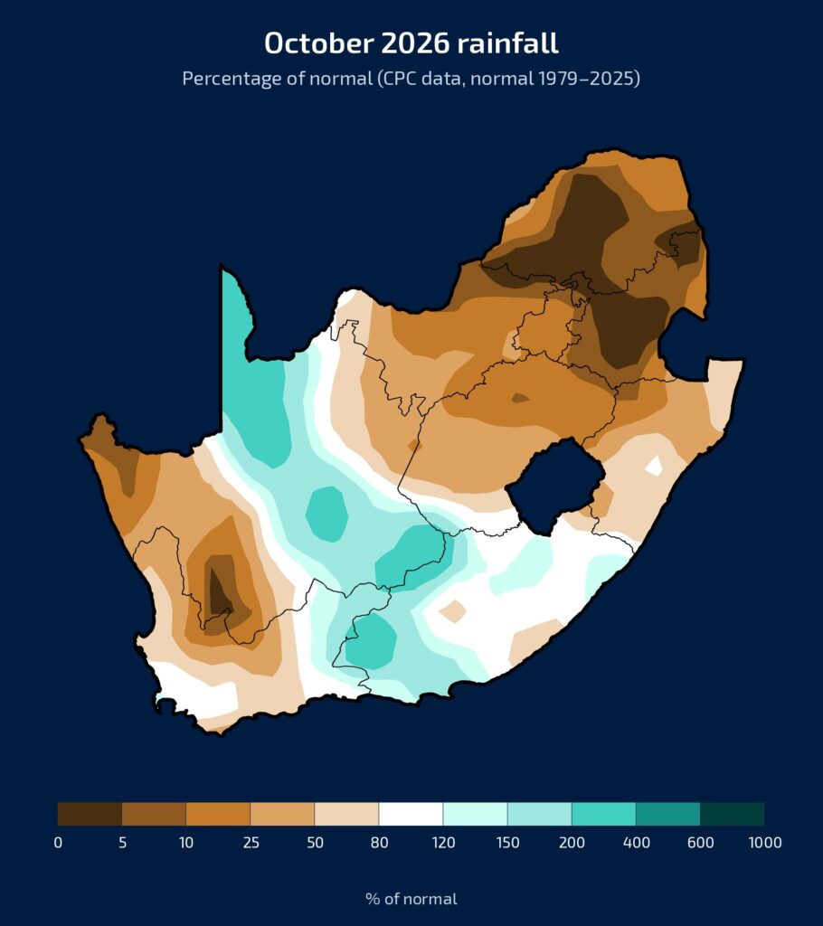
As usual, we start with rainfall as a percentage of normal. October brought below-normal rain to large parts of the summer rainfall region, especially parts of the Free State, North West, Gauteng, Limpopo, Mpumalanga and KwaZulu-Natal.
Many places received less than half of their normal October rainfall, and in the darkest brown areas less than a quarter.
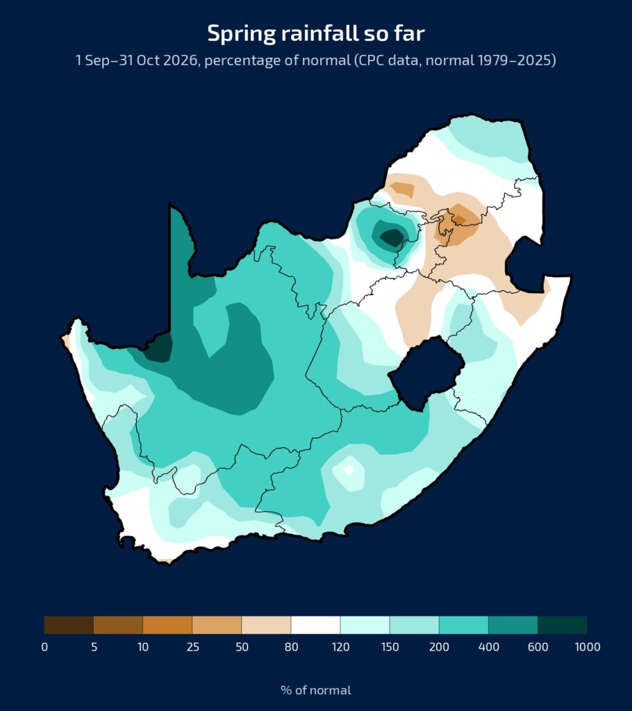
Spring so far, September and October combined, tells a very different story, with average to above-average rain over large parts of the country.
It is worth remembering, though, that this early in the season normal rainfall is a small number in many places, so one or two good showers can produce a very large percentage.
One of the Hottest Octobers on Record
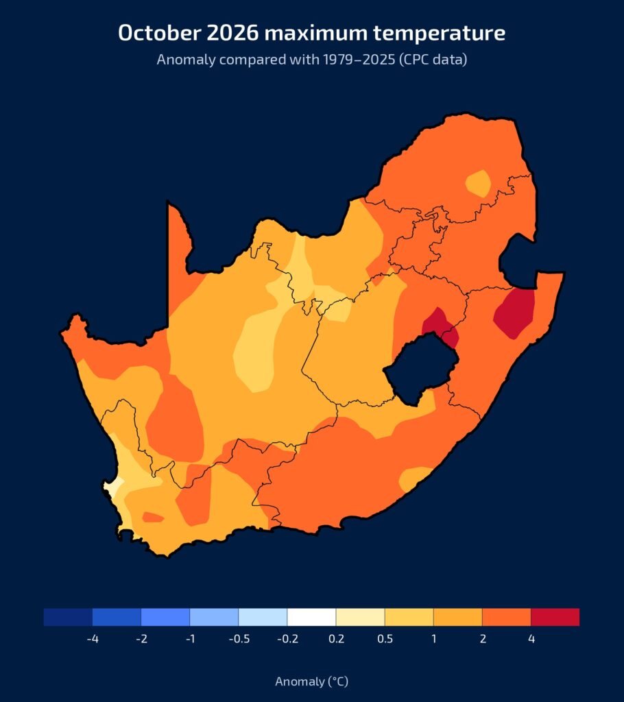
October was not only dry, it was also hot. Maximum temperatures were above normal across the whole country, about 2°C above normal on average, and up to 5°C above normal in parts of the east.
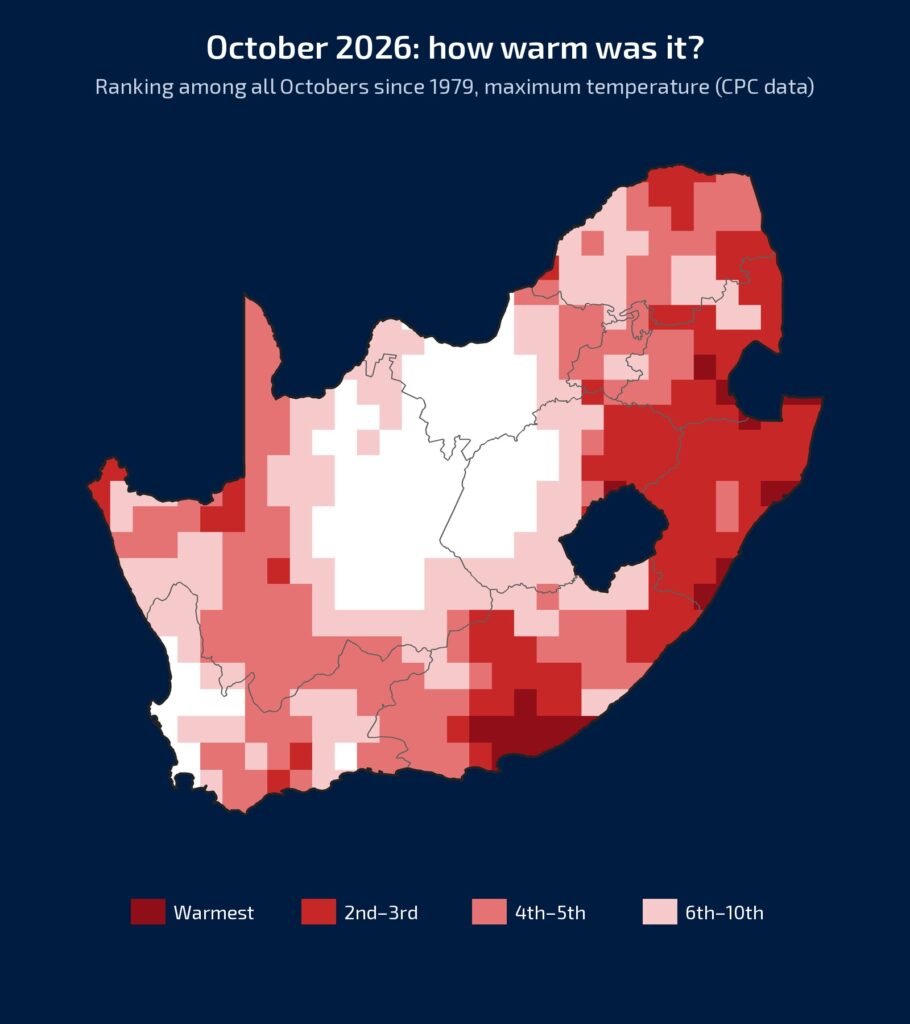
The ranking map shows how exceptional this was. Over about 80% of the country, it was one of the ten warmest Octobers since 1979. Over most of KwaZulu-Natal it was the second or third warmest, and in the south-east of the Eastern Cape the warmest on record. This matters, because hot days draw moisture out of the soil quickly, just when it is needed most.
So although spring has not been unusually dry so far, October was hotter and drier than normal. But how will summer play out?
El Niño: Very Strong, but No Guarantee
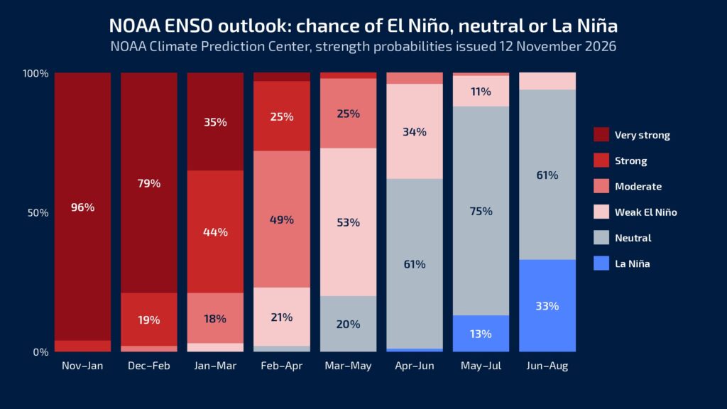
To understand what the summer may hold, we first have to look at the Pacific Ocean, where El Niño is well established and still strengthening. The latest outlook from the US National Oceanic and Atmospheric Administration (NOAA), issued on 12 November, shows El Niño as virtually certain until about February to April, with a chance of 98% or higher.
And this is no ordinary El Niño. For December to February there is a 79% chance of a very strong event, and NOAA gives a 79% chance that it stays strong to very strong through January to March.
There is also about a 60% chance that it becomes the strongest El Niño since 1950 over November to January. El Niño is expected to start weakening early in 2027, and by April to June neutral conditions are most likely.
A very strong El Niño raises the risk of a drier summer for South Africa, but it is no guarantee.
Seasonal Rainfall Outlooks
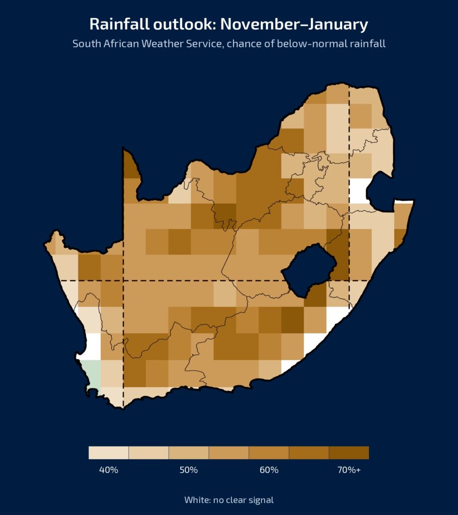
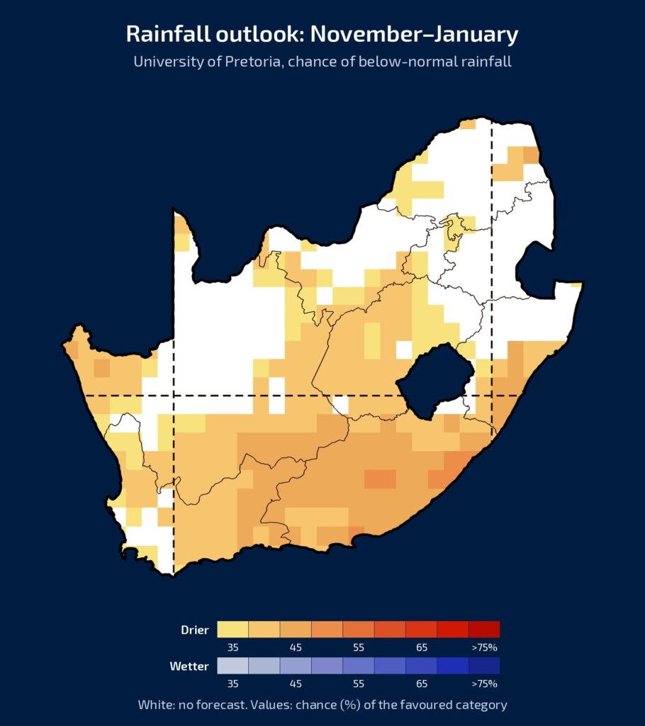
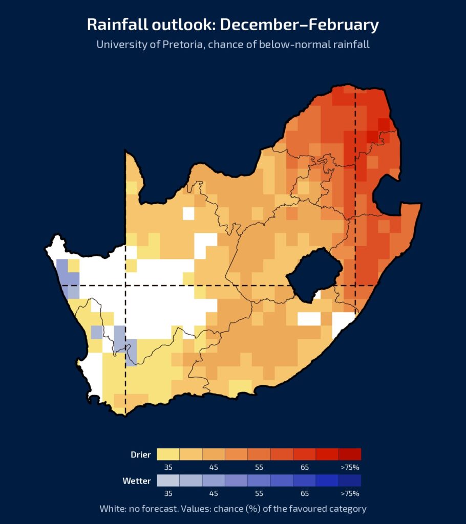
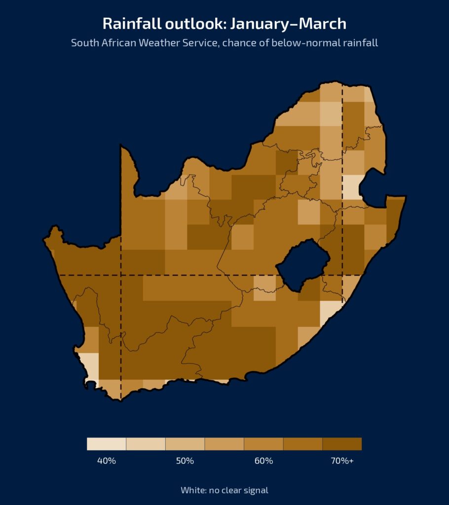
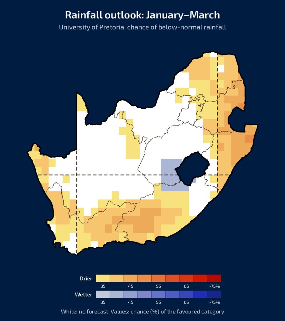
So what does this mean for our rainfall this summer? We compare two seasonal forecasts in the maps below: the South African Weather Service (SAWS) on the left, and the University of Pretoria’s Seasonal Forecast Worx on the right.
For November to January, both lean towards drier than normal over large parts of the country. The white areas on the University’s map mean there is no forecast, so over the north there is not yet a clear signal.
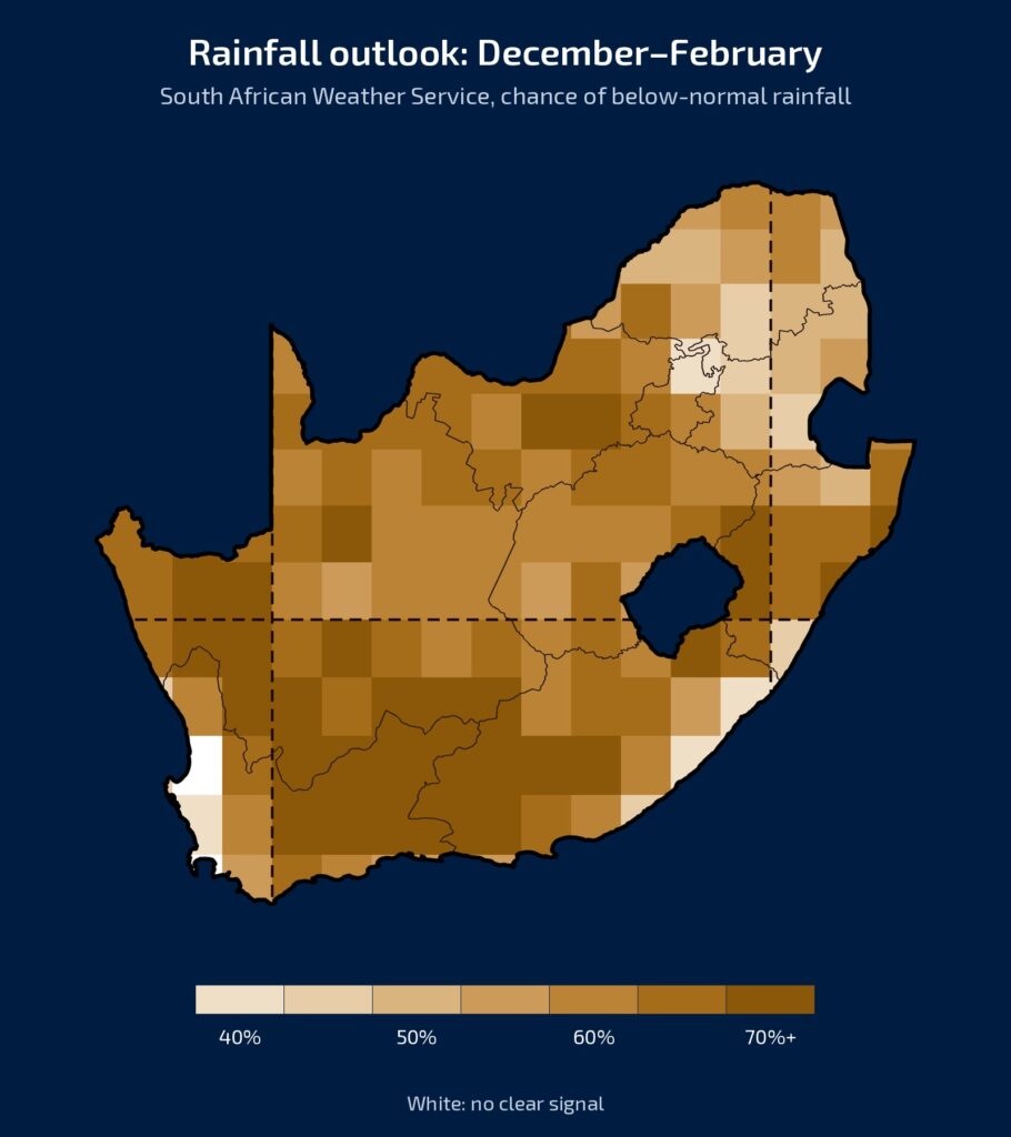
December to February is where the two agree best, with both showing drier conditions over most of the country, as seen in the maps below.
In January to March, however, they differ. The Weather Service remains very dry, as seen on the map below on the left, while the University’s map is white over large parts of the interior.
How far can we trust the maps?
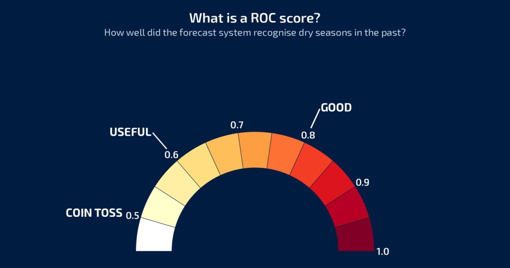
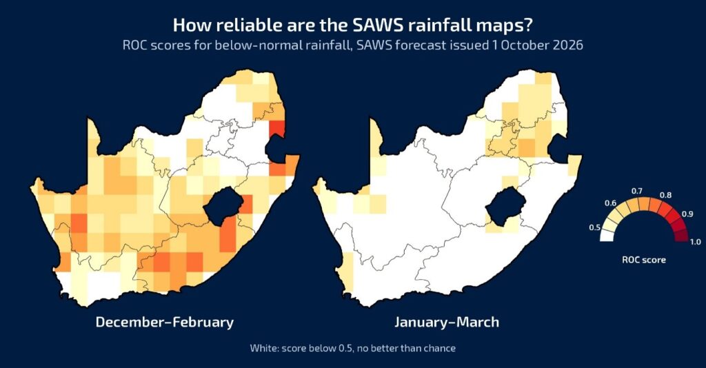
So how do we know which map to trust? This is where the ROC score comes in. ROC stands for Relative Operating Characteristic, but the idea is simple: the forecast system is tested against previous seasons to see how well it could tell dry seasons apart from the others.
A score of 0.5 is like tossing a coin, a 50-50 chance.
From about 0.6 the forecast becomes useful, and from 0.8 it is good.
This matters because a strong signal on a map does not automatically mean we can trust it. The ROC score shows where the signal is reliable, and where it is not.
For December to February, the Weather Service’s map is useful over about half of the country.
But for January to March, the driest map, about three-quarters of the country is white: there, the system has done no better than chance in the past. The risk of a drier summer is therefore real, but there is still a lot of uncertainty, especially for late summer.
Hotter Than Normal: Here We Are Much More Confident
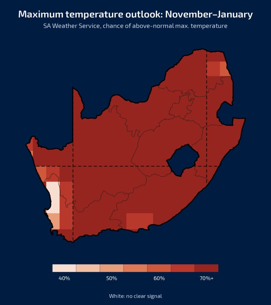
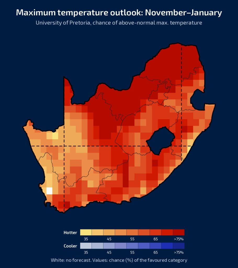
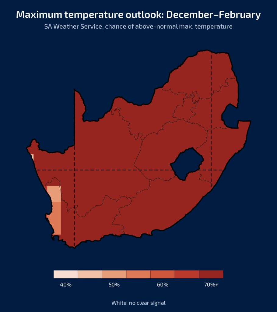
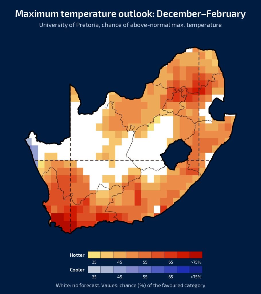
One thing we are far more certain about is that it will be hotter than normal, and we can already see this in November, with above-normal temperatures expected over almost the whole country during the month.
The seasonal maps confirm this. For November to January, both show much warmer than normal conditions over almost the whole country. On the SAWS maps, nearly the whole country falls in the highest category, a 70% or higher chance, and the ROC scores over the interior are mostly above 0.7. For December to February, the two agree again, except over the central interior, where the University of Pretoria shows no clear signal. SAWS stays in the highest category, again with scores mostly above 0.7.
We are therefore much more confident about the heat than about the rain.
In Summary
Spring started wet, and the summer rainfall region could still expect rain in November. The summer will probably be warmer than normal, and the risk of a drier season is real. But nothing is decided yet: even a strong El Niño is no guarantee, and good rain remains possible, especially because late summer is still very uncertain.
Make the most of the moisture when it comes, and plan for heat and water stress, but also keep an eye out for opportunities.
Vox Weather will keep you updated with a new long-term forecast on Landbou.com every month.