Some early snow forecasts recently circulated on social media suggested possible snowfall over parts of Gauteng, North West, the Highveld, and other areas that rarely experience snow during late July. At Vox Weather, we chose not to post about these projections – and here’s why.
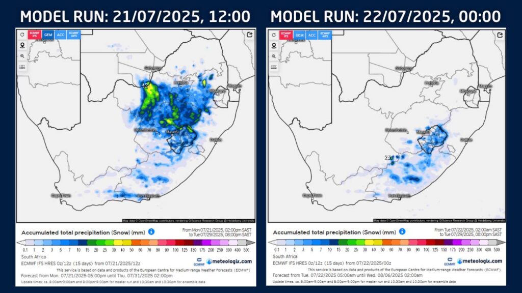
Advanced snow forecasts, particularly more than five days ahead, are often subject to significant change. In fact, updated model guidance today NO LONGER indicates snowfall over these north-eastern regions at all.
Our approach as meteorologists to snow forecasting involves more than just looking at model snowfall outputs.
We analyse:
- The SYNOPTIC SYSTEM expected (e.g. a cold front or cut-off low);
- The availability and timing of PRECIPITATION; and
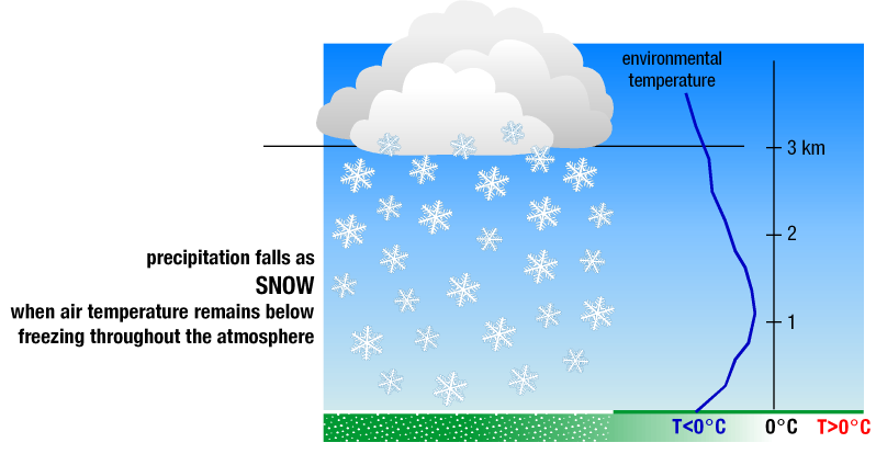
- The FREEZING LEVELS (the altitude at which temperatures are cold enough for snow to form and reach the ground).
These factors must all align for snowfall to be possible. A shift in any of them can lead to significant changes in where snow may fall – or if it occurs at all.
As of the latest forecast, we see:
- A cold front expected to move in on Friday 25 July.
- A strong ridging high-pressure system to follow, introducing colder air over southern South Africa during the weekend of 26 and 27 July.
- Forecast snowfall now largely restricted to the Eastern Cape, Lesotho, the southern Free State, and adjacent high-lying areas.

At Vox Weather, we prefer to wait until we see consistency in multiple forecast runs – usually within a five-day window – before communicating potential snowfall.
This ensures that our updates are as accurate and reliable as possible.