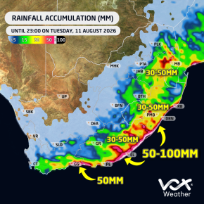
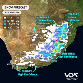
A strong cold front is expected to reach South Africa on Sunday 09 August, followed by the development of a cut-off low from Monday. Vox Weather Meteorologist Michelle du Plessis rounds up the forecast for the Women’s Day long weekend and beyond.
Forecast confidence has improved for Sunday and Monday, with more than one model now indicating significant snowfall over parts of the eastern interior. However, Tuesday’s forecast remains uncertain.
Sunday 9 August
The cold front will move across the southern parts of the country, bringing cold, wet and windy weather.
🌧️ The heaviest rainfall is expected along the South Coast, including the Garden Route, and across large parts of the Eastern Cape. Up to 20 mm of rain could fall in some areas during the day.
❄️ Only light snowfall is currently expected over the mountains of the Western Cape, around Sutherland and the Nuweveld Mountains.
Heavier snowfall is likely over the mountains and high-lying areas of the Eastern Cape, where some locations could already receive around 10 cm of snow.
Snow will also begin spreading towards Lesotho, the southern Drakensberg and nearby high-lying areas.
Monday 10 August
A high-pressure system ridging behind the cold front will maintain cold, wet and windy conditions along the southern and eastern coastline, with another 10 mm of rain possible along parts of the South Coast.
Meanwhile, a cut-off low is expected to develop and bring heavier rain farther east.
🌧️ The heaviest rainfall is currently expected over KwaZulu-Natal, the Highveld and eastern Free State, where 15–30 mm could fall within 24 hours. Isolated showers and thunderstorms are also likely over Gauteng, Limpopo and North West.
❄️ Both the European Centre for Medium-Range Weather Forecasts (ECMWF) and Global Forecast System (GFS) models are indicating the likelihood of significant snowfall over:
- The Eastern Free State
- The bordering areas of Free State and KwaZulu-Natal
- The Mpumalanga Highveld, including areas around Ermelo, Dullstroom and Standerton
- Lesotho and the southern Drakensberg
- The KwaZulu-Natal Midlands, including areas around Underberg and Kokstad
- High-lying parts of the Eastern Cape
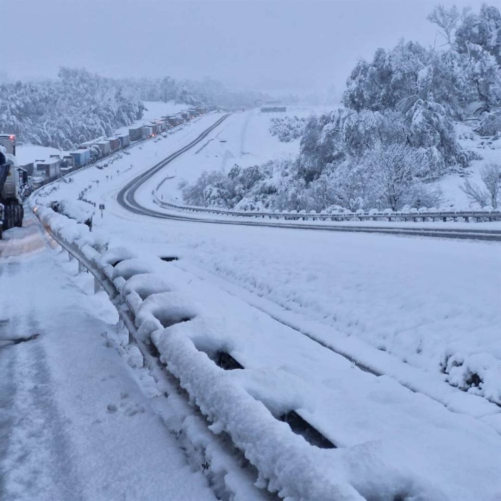
Major travel disruptions are possible. Van Reenen’s Pass and other mountain routes could close.
As seen during the September 2024 snow event, vehicles can become trapped for hours. Avoid unnecessary travel between Free State, KwaZulu-Natal and Mpumalanga on the public holiday and Tuesday.
Light snow remains possible over south-eastern Gauteng, including places like Delmas, Nigel, Benoni and Vereeniging.
Snow is not currently expected in Pretoria, and any snow falling with rain over Gauteng may struggle to settle.
Image: Snow at Van Reenen’s Pass, 2024 (image: The Citizen)
Tuesday 11 August
Tuesday’s rainfall and snowfall forecasts remain highly uncertain due to differences between the major forecast models.
🌧️ The ECMWF model is indicating potentially heavy rainfall over eastern Limpopo and Mpumalanga, with isolated totals of up to 50 mm. It is also showing up to 50 mm along parts of the East Coast.
However, the GFS model is not currently showing the same level of heavy rainfall over the north-east.
❄️ The ECMWF model is indicating further snowfall over:
- The Mpumalanga Highveld
- South-eastern Gauteng
- The Eastern Free State
- Lesotho and the southern Drakensberg
In contrast, the GFS model currently limits Tuesday’s snowfall mainly to the southern Drakensberg.
We therefore cannot yet say with certainty how Tuesday will unfold.
Important Forecast Note
More than one forecast model is now in reasonable agreement regarding the expected rain, cold and snow on Sunday and Monday.
However, the exact position and strength of the cut-off low will determine where the heaviest rain and snow occur, particularly on Tuesday.
Even a small shift in the system could significantly change the forecast.
Vox Weather will provide another detailed update on Sunday as the system moves closer and forecast confidence improves.
One thing remains certain: A MAJOR COLD BLAST IS ON THE WAY! 🥶❄️🌧️